
IMAGES TAKEN NEAR TO
Wendon Close, ROCHFORD, SS4 1UF
Introduction
This page details the photographs taken nearby to Wendon Close, SS4 1UF by members of the Geograph project.
The Geograph project started in 2005 with the aim of publishing, organising and preserving representative images for every square kilometre of Great Britain, Ireland and the Isle of Man.

There are currently over 7.5m images from over14,400 individuals and you can help contribute to the project by visiting https://www.geograph.org.uk
Image Map
Images are licensed for reuse under creativecommons.org/licenses/by-sa/2.0
Notes
- Clicking on the map will re-center to the selected point.
- The higher the marker number, the further away the image location is from the centre of the postcode.
Image Listing (13 Images Found)
Images are licensed for reuse under creativecommons.org/licenses/by-sa/2.0
Image
Details
Distance
1
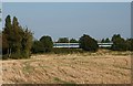
One Train, heading for London
Looking East across the field, towards a London bound train, running through Hawkwell, Essex.
Image: © Paul Collins
Taken: 15 Sep 2007
0.14 miles
2
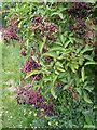
Ripening elderberries
In the hedge along the railway boundary.
Image: © Robin Webster
Taken: 30 Jul 2017
0.15 miles
3
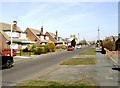
Eastbury Avenue, Rochford
From the early 1950s onward residential development began to cover the parts of the gridsquare to the north-east of the Southend Victoria to Shenfield railway following its electrification. Chalet-type houses such as these are typical of the area. Taken near the junction with Parklands looking north.
Image: © David Kemp
Taken: 23 Mar 2006
0.15 miles
4
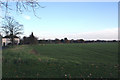
Farm View
These are some of the fields of Hawkwell Hall Farm. The railway line is evident across the centre of the picture.
Image: © terry joyce
Taken: 26 Nov 2010
0.19 miles
5
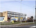
Golden Cross near Rochford
The Golden Cross area typifies the look of urban clutter that characterises certain parts of south-east Essex. Taken at the junction of Rectory Road and Ashingdon Road looking north-west.
Image: © David Kemp
Taken: 13 Mar 2006
0.19 miles
7
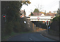
Railway Bridge
This bridge carries trains on the London Liverpool Street to Southend Victoria Line. It is very narrow and as you can see the traffic flow is controlled by lights.
Image: © terry joyce
Taken: 26 Nov 2010
0.22 miles
8
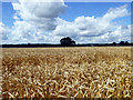
Wheat field, Hawkwell
Ready for harvesting, by the looks of it.
Image: © Robin Webster
Taken: 30 Jul 2017
0.22 miles
9
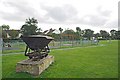
Magnolia Park
Magnolia Park and The Magnolia Nature reserve see
http://www.wildessex.net/sites/Magnolia%20Nature%20Reserve.htm are built on the site of a former Brickworks. Here you can see illustrations of the past and current usage.
Image: © Glyn Baker
Taken: 18 Sep 2010
0.23 miles
10
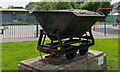
Tipping hopper, Magnolia Fields Local Nature Reserve, Hawkwell
This is a typical narrow-gauge contractor's tipping hopper built in the thousands and used for the transport of materials around a site. In this instance, probably used to carry brick clay from the fields to the works/kilns.
Sometimes known as Magnolia Park, this wagon is a reminder that this area was once industrial, much of this area was originally a brickworks, where both sand and clay were extracted.
Image: © Roger Jones
Taken: 18 May 2022
0.23 miles