
IMAGES TAKEN NEAR TO
Ashingdon Road, ROCHFORD, SS4 1NH
Introduction
This page details the photographs taken nearby to Ashingdon Road, SS4 1NH by members of the Geograph project.
The Geograph project started in 2005 with the aim of publishing, organising and preserving representative images for every square kilometre of Great Britain, Ireland and the Isle of Man.

There are currently over 7.5m images from over14,400 individuals and you can help contribute to the project by visiting https://www.geograph.org.uk
Image Map
Images are licensed for reuse under creativecommons.org/licenses/by-sa/2.0
Notes
- Clicking on the map will re-center to the selected point.
- The higher the marker number, the further away the image location is from the centre of the postcode.
Image Listing (30 Images Found)
Images are licensed for reuse under creativecommons.org/licenses/by-sa/2.0
Image
Details
Distance
3

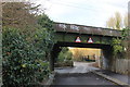
Railway bridge 785 SSV, Ironwell Lane
The Southend Victoria line crosses.
Image: © Robin Webster
Taken: 30 Jul 2017
0.05 miles
4
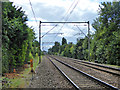
Southend Victoria line
Looking in the down direction, next station Rochford. The overhead support gantries are a design relic from the 1950s when the line was electrified at 1500 V d.c. It was later changed to 6.25 kV a.c. and then 25 kV a.c.
Image: © Robin Webster
Taken: 30 Jul 2017
0.12 miles
5
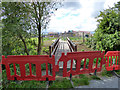
New footbridge, not yet open
A link from a new and incomplete housing estate to Ironwell Lane, a public byway.
Image: © Robin Webster
Taken: 30 Jul 2017
0.13 miles
6
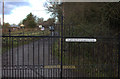
Meadow Brook stud farm gate.
A stern warning
Image: © Robert Eva
Taken: 11 Jan 2017
0.13 miles
7
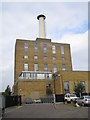
Rochford: St Luke's Hospital chimney
A prominent landmark on Rochford's horizon, I think the title is correct. No doubt someone will "advise" me if I am not!
Image: © Nigel Cox
Taken: 15 Aug 2006
0.15 miles
8
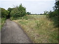
Rochford: Ironwell Lane
An example of a Byway Open to All Traffic (a BOAT), this lane leads to Hawkwell from Rochford.
Image: © Nigel Cox
Taken: 15 Aug 2006
0.16 miles
9
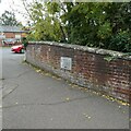
Old Boundary Marker
Bridge Marker, a carved stone plaque set in the eastern parapet of the bridge on Hall Road over the River Roach, just south of the junction with Church Street. Rochford parish. Inscribed 1777 and moved from the bridge demolished in 1970.
REPORTED BY, AND POSTED IN MEMORY OF, JOHN V NICHOLLS 1943 – 2020
Milestone Society National ID: EX_ROCH01br
Image: © M Bardell
Taken: 16 Oct 2020
0.16 miles
10
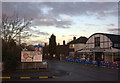
Road junction sign and Whittingham's garage
Image: © Robert Eva
Taken: 11 Jan 2017
0.17 miles