IMAGES TAKEN NEAR TO
Elm Road, SOUTHEND-ON-SEA, SS3 9PB
Introduction
This page details the photographs taken nearby to Elm Road, SS3 9PB by members of the Geograph project.
The Geograph project started in 2005 with the aim of publishing, organising and preserving representative images for every square kilometre of Great Britain, Ireland and the Isle of Man.

There are currently over 7.5m images from over14,400 individuals and you can help contribute to the project by visiting https://www.geograph.org.uk
Image Map
Images are licensed for reuse under creativecommons.org/licenses/by-sa/2.0
Notes
- Clicking on the map will re-center to the selected point.
- The higher the marker number, the further away the image location is from the centre of the postcode.
Image Listing (26 Images Found)
Images are licensed for reuse under creativecommons.org/licenses/by-sa/2.0
Image
Details
Distance
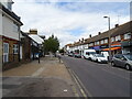
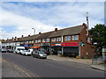
1
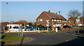
Ness Road roundabout, Shoeburyness
Elm Road leads off to the right.
Image: © David Kemp
Taken: 22 Feb 2018
0.07 miles
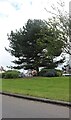
4
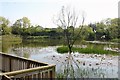
Shoebury Park Lake
A former pit from which brickearth would have been most likely extracted.
Image: © David Kemp
Taken: 6 May 2016
0.12 miles
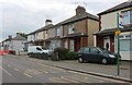
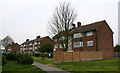
5
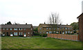
Ness Road, Shoeburyness
Former local authority housing built in the mid-C20.
Image: © David Kemp
Taken: 16 Apr 2019
0.14 miles
6
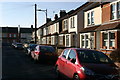
Trafalgar Road, Shoeburyness
Trafalgar Road is one of a number of late-C19/early-C20 streets in the Cambridge Town district of Shoeburyness built for civilian workers at the former Shoebury Garrison which closed in 1976. West Road can be seen in the background.
Image: © David Kemp
Taken: 22 Feb 2018
0.14 miles
8
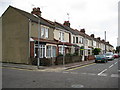
Shoeburyness: Waterloo Road
Waterloo Road is in Cambridge Town. Nowadays Cambridge Town merges into the built-up area of Thorpe Bay and the rest of the conurbation of Southend-on-Sea, but looking at old Ordnance Survey maps of the Victorian period the isolation of the settlement and its role in providing accommodation to civilian workers for the military garrison at Shoeburyness is quite evident. Waterloo Road does not appear in the Ordnance Survey map of 1898 although the next street to the south, once Grove Road, but now Chelmer Road, is shown.
Image: © Nigel Cox
Taken: 3 Aug 2008
0.15 miles
10
Flats in Delaware Crescent, Shoeburyness
Image: © David Kemp
Taken: 16 Apr 2019
0.16 miles