
IMAGES TAKEN NEAR TO
Ness Road, SOUTHEND-ON-SEA, SS3 9DH
Introduction
This page details the photographs taken nearby to Ness Road, SS3 9DH by members of the Geograph project.
The Geograph project started in 2005 with the aim of publishing, organising and preserving representative images for every square kilometre of Great Britain, Ireland and the Isle of Man.

There are currently over 7.5m images from over14,400 individuals and you can help contribute to the project by visiting https://www.geograph.org.uk
Image Map
Images are licensed for reuse under creativecommons.org/licenses/by-sa/2.0
Notes
- Clicking on the map will re-center to the selected point.
- The higher the marker number, the further away the image location is from the centre of the postcode.
Image Listing (38 Images Found)
Images are licensed for reuse under creativecommons.org/licenses/by-sa/2.0
Image
Details
Distance
1
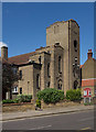
Shoeburyness : St George & The English Martyrs Roman Catholic Church
Built in 1938-1929 to a design by architect Thomas H. B. Scott - https://c20society.org.uk/churches/st-george-and-the-english-martyrs/.
Image: © Jim Osley
Taken: 28 Jul 2018
0.04 miles
3
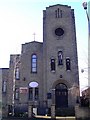
St George and the English Martyrs
The Catholic church On Ness Road, Shoeburyness. The three figures can be seen in the windows here.
http://www.stgeorgesrcchurch.co.uk/
Image: © Julieanne Savage
Taken: 10 Jan 2007
0.05 miles
5
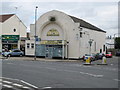
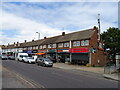
Shoebury: Former Palace Cinema
Built in 1913, the Palace Cinema was hugely popular with the soldiers of the nearby Shoebury Garrison, but the last film was shown in the 1960s. It then became a camping equipment shop, Shoebury Outdoor Leisure, which itself closed early in 2008. The building and its site are now reputedly owned by a company whose intention is to construct residential flats on the site. However there is local opposition to this, and many, fronted by the jazz trumpeter Digby Fairweather, would like to see the building saved.
In the meantime a buddleia grows uncannily in the dead centre of the front façade.
On a different geographical note entirely, if you follow the arterial A13 trunk road out of London for its entire length, it ends in the front of the cinema, here on Ness Road.
On another Geographical note the Ordnance Survey's 1:10,000 scale mapping shows that the 185000 metre northern gridline runs through the centre of the front façade of the building and exits through the middle of the right hand side.
Image: © Nigel Cox
Taken: 3 Aug 2008
0.06 miles
6
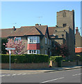
St George (RC), Shoeburyness & presbytery
The two buildings face Ness Road.
Image: © David Kemp
Taken: 23 Apr 2015
0.06 miles
7
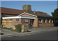
Church hall, St George (RC), Shoeburyness
The church hall stands in St Andrew's Road. Part of the church itself can be seen behind in Ness Road.
Image: © David Kemp
Taken: 23 Apr 2015
0.06 miles
9
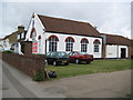
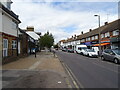
Shoeburyness Methodist Church
The church is in St Andrew's Road. It is not shown on the Ordnance Survey map edition of 1898, but the records of the church in the National Archives date from 1899, so it is reasonable to assume that the church dates from this time.
Image: © Nigel Cox
Taken: 3 Aug 2008
0.09 miles
10
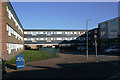
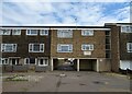
Flats in Avon Way, Shoeburyness
Avon Way stands (more or less) on the site of Cambridge Road, a street of C19 terraced houses similar to those in Trafalgar Road Image nearby.
Image: © David Kemp
Taken: 22 Feb 2018
0.09 miles