
IMAGES TAKEN NEAR TO
Midsummer Meadow, SOUTHEND-ON-SEA, SS3 8UU
Introduction
This page details the photographs taken nearby to Midsummer Meadow, SS3 8UU by members of the Geograph project.
The Geograph project started in 2005 with the aim of publishing, organising and preserving representative images for every square kilometre of Great Britain, Ireland and the Isle of Man.

There are currently over 7.5m images from over14,400 individuals and you can help contribute to the project by visiting https://www.geograph.org.uk
Image Map
Images are licensed for reuse under creativecommons.org/licenses/by-sa/2.0
Notes
- Clicking on the map will re-center to the selected point.
- The higher the marker number, the further away the image location is from the centre of the postcode.
Image Listing (46 Images Found)
Images are licensed for reuse under creativecommons.org/licenses/by-sa/2.0
Image
Details
Distance
1
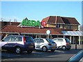
Chav Central
You can now enjoy Chav Central 24 hours a day.
Image: © Julieanne Savage
Taken: 2 Jan 2007
0.06 miles
2
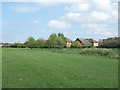
Open space east of North Shoebury Road, Shoeburyness
Although the area looks dense with houses on the map, there is a fair amount of open grassland such as this on either side of North Shoebury Road. The houses in the foreground are in Mountbatten Drive.
Image: © David Kemp
Taken: 22 Apr 2014
0.08 miles
3
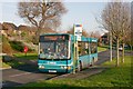
Arriva bus in Ravendale Way, Shoeburyness
Arriva 3500 has just turned left out of Mountbatten Drive (right) and is about to set a passenger down at the first stop in Ravendale Way. This particular bus used to be in red London livery and worked in the Havering area, but was sent to Southend in 2012 and painted blue.
Image: © David Kemp
Taken: 17 Dec 2012
0.11 miles
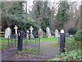
5
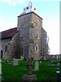
St Mary's Parish Church
North Shoebury off the A13..
Image: © Julieanne Savage
Taken: 3 Jan 2007
0.12 miles
6
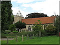
St Mary's Shoeburyness
It's a shame they built the church next to a huge Asda supermarket. What were these medieval planners thinking of?
Image: © william
Taken: 12 Sep 2010
0.12 miles
7
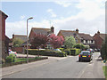
Chertsey Close, Shoeburyness
In common with a number of other roads in the vicinity (such as Bray Court, Caversham Avenue, Cookham Court, Datchet Drive, Eton Walk, Kingston Avenue, Sonning Way, Sunbury Court, Weybridge Walk, Woodley Walk), Chertsey Close bears the name of a place in the Thames Valley.
Image: © David Kemp
Taken: 18 Apr 2014
0.12 miles
9
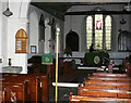
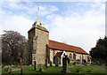
Interior of St Mary the Virgin, North Shoebury
Shows the east end of the church.
Image: © David Kemp
Taken: 13 Oct 2012
0.13 miles
10
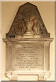
St Mary, North Shoebury - Wall monument
Image: © John Salmon
Taken: 3 Apr 2014
0.13 miles