
IMAGES TAKEN NEAR TO
Maldon Road, SOUTHEND-ON-SEA, SS2 5AZ
Introduction
This page details the photographs taken nearby to Maldon Road, SS2 5AZ by members of the Geograph project.
The Geograph project started in 2005 with the aim of publishing, organising and preserving representative images for every square kilometre of Great Britain, Ireland and the Isle of Man.

There are currently over 7.5m images from over14,400 individuals and you can help contribute to the project by visiting https://www.geograph.org.uk
Image Map
Images are licensed for reuse under creativecommons.org/licenses/by-sa/2.0
Notes
- Clicking on the map will re-center to the selected point.
- The higher the marker number, the further away the image location is from the centre of the postcode.
Image Listing (34 Images Found)
Images are licensed for reuse under creativecommons.org/licenses/by-sa/2.0
Image
Details
Distance
1
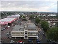
View North over Southend on Sea
B&Q and car park near Southend Victoria Railway Station
Image: © Road Engineer
Taken: 29 Sep 2006
0.15 miles
2
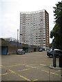
Southend: Pennine towerblock, Coleman Street
Pennine is one of four identical council tower blocks near Southend Victoria railway station, the others being Quantock, Chiltern and Malvern. They are 16 floors high with 105 flats each and their roof heights are about 47 metres, or about 154 feet above the ground level.
Image: © Nigel Cox
Taken: 3 Aug 2008
0.15 miles
3
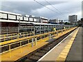
Train servicing facilities at Southend Victoria
Image: © David Robinson
Taken: 8 Sep 2022
0.16 miles
4
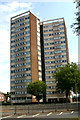
Pennine, Coleman Street, Southend-on-Sea
This is the south-west elevation of the block. Pennine along with Quantock, Chiltern and Malvern comprise the Queensway Estate whose first tenants moved in from 1967 onwards. The estate was built in conjunction with the Queensway Ring Road scheme and replaced a grid of long-forgotten terraced streets built in the late C19. In the intervening years the estate has been beset by all the issues affecting other such high-rise developments and there are frequent calls for its major refurbishment or demolition.
Image: © David Kemp
Taken: 11 Jul 2019
0.16 miles
5
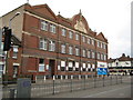
Southend: Co-op bakery, Sutton Road
I can find absolutely nothing on the internet about this building, which is on Sutton Road at its junction with Guildford Road. The inscription in the massive stone carving states that the building was opened as a bakery in 1921 by the London Co-operative Society Limited to the designs of H E Tufton. The Co-op evidently still operate out of the building as evidenced by the store logo at the far right hand end, but whether the bakery still functions is unknown to me. In complete contrast to the massiveness of the building the stone carving also has a beehive with intricately carved bees buzzing around. Again I do not know if this was a former logo of the Co-operative Society or a symbol of the building being a bakery.
Image: © Nigel Cox
Taken: 3 Aug 2008
0.16 miles
6
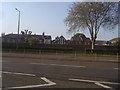
Buildings along Queensway, Southend
These buildings were clearly there long before Queensway, and a wall needed to be built partly to stop children getting onto the dual carriageway.
Image: © David Howard
Taken: 24 May 2012
0.16 miles
7
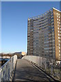
Footbridge over the A13, Queensway
Pennine towerblock
Image: © John Myers
Taken: 1 Feb 2010
0.16 miles
8
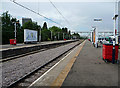
Southend Victoria
Southend Victoria railway station is the eastern terminus of the line from London Liverpool Street.
Image: © John Allan
Taken: 21 Jul 2010
0.16 miles
9
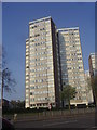
Tower blocks on Queensway, central Southend
Image: © David Howard
Taken: 24 May 2012
0.16 miles
10
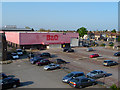
Former Southend B&Q
Superseded by Image
The lettering on the fascia is just the un-faded red paint exposed when the store sign was removed.
Image: © John Allan
Taken: 20 Apr 2011
0.16 miles