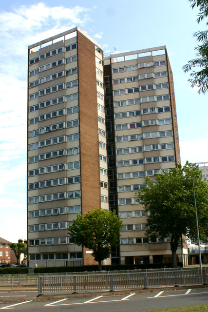
Pennine, Coleman Street, Southend-on-Sea
Introduction
The photograph on this page of Pennine, Coleman Street, Southend-on-Sea by David Kemp as part of the Geograph project.
The Geograph project started in 2005 with the aim of publishing, organising and preserving representative images for every square kilometre of Great Britain, Ireland and the Isle of Man.
There are currently over 7.5m images from over 14,400 individuals and you can help contribute to the project by visiting https://www.geograph.org.uk

Image: © David Kemp Taken: 11 Jul 2019
This is the south-west elevation of the block. Pennine along with Quantock, Chiltern and Malvern comprise the Queensway Estate whose first tenants moved in from 1967 onwards. The estate was built in conjunction with the Queensway Ring Road scheme and replaced a grid of long-forgotten terraced streets built in the late C19. In the intervening years the estate has been beset by all the issues affecting other such high-rise developments and there are frequent calls for its major refurbishment or demolition.

