IMAGES TAKEN NEAR TO
The Manorway, STANFORD-LE-HOPE, SS17 9GN
Introduction
This page details the photographs taken nearby to The Manorway, SS17 9GN by members of the Geograph project.
The Geograph project started in 2005 with the aim of publishing, organising and preserving representative images for every square kilometre of Great Britain, Ireland and the Isle of Man.

There are currently over 7.5m images from over14,400 individuals and you can help contribute to the project by visiting https://www.geograph.org.uk
Image Map
Images are licensed for reuse under creativecommons.org/licenses/by-sa/2.0
Notes
- Clicking on the map will re-center to the selected point.
- The higher the marker number, the further away the image location is from the centre of the postcode.
Image Listing (14 Images Found)
Images are licensed for reuse under creativecommons.org/licenses/by-sa/2.0
Image
Details
Distance
1
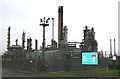
Coryton Oil Refinery
I took the picture by the entrance to the Refinery.
The concrete stack is the one shown on OS Get a Map, at the centre of this grid.
The refinery was originally owned by Mobil, then BP and recently it has been taken over by Petroplus.
Image: © terry joyce
Taken: 16 Oct 2007
0.09 miles
2
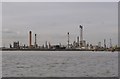
Coryton Oil Refinery
Of the many chimneys of the oil refinery, one was in use and some steam was seen escaping when the ship I was on went past.
Image: © Ashley Dace
Taken: 30 Sep 2010
0.11 miles
4
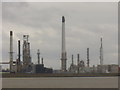
Coryton Oil Refinery
Chimneys and flarestacks tower above the oil refinery built on the Thames Marshes near Canvey Island.
Image: © Colin Smith
Taken: 26 Sep 2010
0.14 miles
5
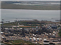
Coryton Oil Refinery
This shows the main processing area of Coryton Oil Refinery, Stanford le Hope. It is operated by Petroplus at present (2010). Previous operators have been Mobil and BP.
The black stick like object at the bottom centre of the picture is one of their flare stacks. The round tanks, known as spheres are Liquid Petroleum Gas storage.
Image: © terry joyce
Taken: 9 Jul 2010
0.14 miles
6

Coryton Energy Company Ltd
Coryton Energy Company Ltd (Intergen), Stands next to Coryton Oil Refinery.
It runs a 753 MegaWatt gas fired power station, which generates electricity to the National Grid.
Image: © terry joyce
Taken: 16 Oct 2007
0.15 miles
7
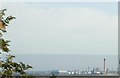
Coryton Oil Refinery
Taken from St. Helen's churchyard, Cliffe on the Isle of Grain.
Image: © Phillip Perry
Taken: 2 Oct 2008
0.17 miles
8
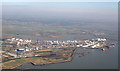
Aerial Photo of Coryton Oil Refinery
Coryton Oil Refinery covers 7 grids. Image Image Image Image Image Image and Image The main part of the Refinery appears to be in this grid, the rest appears to be tankage and jetties.
All 7 grids are in this photo.
Image: © terry joyce
Taken: 19 Oct 2007
0.17 miles
9
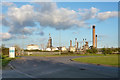
Disused Coryton refinery, 2015
Production finished in 2012.
Image: © Robin Webster
Taken: 19 Apr 2015
0.17 miles