IMAGES TAKEN NEAR TO
Thames Haven Road, STANFORD-LE-HOPE, SS17 7RN
Introduction
This page details the photographs taken nearby to Thames Haven Road, SS17 7RN by members of the Geograph project.
The Geograph project started in 2005 with the aim of publishing, organising and preserving representative images for every square kilometre of Great Britain, Ireland and the Isle of Man.

There are currently over 7.5m images from over14,400 individuals and you can help contribute to the project by visiting https://www.geograph.org.uk
Image Map
Images are licensed for reuse under creativecommons.org/licenses/by-sa/2.0
Notes
- Clicking on the map will re-center to the selected point.
- The higher the marker number, the further away the image location is from the centre of the postcode.
Image Listing (33 Images Found)
Images are licensed for reuse under creativecommons.org/licenses/by-sa/2.0
Image
Details
Distance
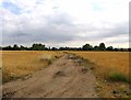
1

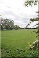
Footpath Near Old Hall
On the outskirts of Corringham.
Image: © Glyn Baker
Taken: 14 May 2016
0.07 miles
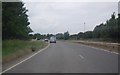
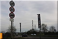
2

Footpath 20, Corringham
In the distance you can see the Image (DP World)
Image: © Glyn Baker
Taken: 14 May 2016
0.07 miles
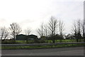
5
Corringham Athletic Football Ground
This is also footpath 29.
Image: © Glyn Baker
Taken: 14 May 2016
0.11 miles
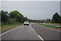
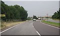
10
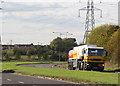
The Manorway
The Manorway or A1014 is the link road between the A13 and Coryton Oil Refinery.
This picture was taken by the No 1 entrance to Shell Haven.
As Shell Haven no longer produces petrol, the tanker is on its way to fill up at Coryton.
Image: © terry joyce
Taken: 18 Oct 2007
0.20 miles