
IMAGES TAKEN NEAR TO
Homestead Drive, BASILDON, SS16 5PE
Introduction
This page details the photographs taken nearby to Homestead Drive, SS16 5PE by members of the Geograph project.
The Geograph project started in 2005 with the aim of publishing, organising and preserving representative images for every square kilometre of Great Britain, Ireland and the Isle of Man.

There are currently over 7.5m images from over14,400 individuals and you can help contribute to the project by visiting https://www.geograph.org.uk
Image Map
Images are licensed for reuse under creativecommons.org/licenses/by-sa/2.0
Notes
- Clicking on the map will re-center to the selected point.
- The higher the marker number, the further away the image location is from the centre of the postcode.
Image Listing (13 Images Found)
Images are licensed for reuse under creativecommons.org/licenses/by-sa/2.0
Image
Details
Distance
1
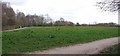
Westley Heights country park
An open area near the car park. I am afraid there were a lot of dog walkers who don't seem to realise that Covid-19 rules mean that you are meant to walk or cycle from your home for your exercise.
Image: © Glyn Baker
Taken: 28 Mar 2020
0.09 miles
2
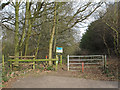
Willow Park Entrance, Langdon Nature Reserve
The entrance to Willow Park and Kingston Ridge from Kingston Hill.
Willow Park is part of the Essex Wildlife Trust's Langdon Nature Reserve.
Image: © Roger Jones
Taken: 2 Mar 2013
0.09 miles
3
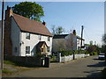
Cottages
Two weatherboard cottages in Lee Chapel Lane, the nearer with a recently added red-tiled porch.
Image: © William Metcalfe
Taken: 18 Apr 2007
0.11 miles
4
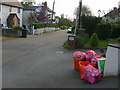
Recycling
The pink sacks contain paper, card, cans and plastics bottles while the orange crates are reserved for glass. This house in Lee Chapel Lane is doing its bit for recycling.
Image: © William Metcalfe
Taken: 25 Apr 2007
0.12 miles
5
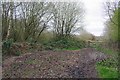
Gates in Willow Park
Willow Park is part of Essex Wildlife Trust's https://www.essexwt.org.uk/ Langdon Hills complex of reserves.
Image: © Glyn Baker
Taken: 28 Mar 2020
0.18 miles
6
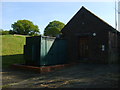
Underground reservoir
Buildings and plant supporting an underground reservoir at the Staneway entrance to Marks Hill Wood.
Image: © William Metcalfe
Taken: 18 Apr 2007
0.18 miles
7
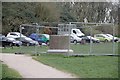
Wot's This 'Ere Then?
I wonder what on earth is being constructed here? The structure looks like an upended concrete drainage pipe filled with concrete.
Image: © Glyn Baker
Taken: 28 Mar 2020
0.18 miles
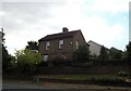
9
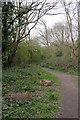
Woodland Path in Willow Park
Part of Essex Wildlife Trust's https://www.essexwt.org.uk/ Langdon Hills complex of reserves.
Image: © Glyn Baker
Taken: 28 Mar 2020
0.19 miles
10

Nature Reserve path, Westley Heights,
One of the Langdon Hills reserves that sit on a ridge of high ground to the South-west of Basildon, Essex. The other being One Tree Hill.
Image: © Derek Voller
Taken: 9 Oct 2013
0.22 miles