
IMAGES TAKEN NEAR TO
Creek View, BASILDON, SS16 4RU
Introduction
This page details the photographs taken nearby to Creek View, SS16 4RU by members of the Geograph project.
The Geograph project started in 2005 with the aim of publishing, organising and preserving representative images for every square kilometre of Great Britain, Ireland and the Isle of Man.

There are currently over 7.5m images from over14,400 individuals and you can help contribute to the project by visiting https://www.geograph.org.uk
Image Map
Images are licensed for reuse under creativecommons.org/licenses/by-sa/2.0
Notes
- Clicking on the map will re-center to the selected point.
- The higher the marker number, the further away the image location is from the centre of the postcode.
Image Listing (23 Images Found)
Images are licensed for reuse under creativecommons.org/licenses/by-sa/2.0
Image
Details
Distance
1
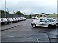
WRVS Vans at Vange
This photo was taken looking east from the footpath that skirts around Vange Wharf. It shows the Women’s Royal Voluntary Service “Meals On Wheels” vehicles in their depot.
Image: © Glyn Baker
Taken: 1 Oct 2005
0.05 miles
3
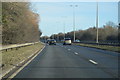
Merricks Lane, Vange
Running parallel with the A13 to the right, but with no connection.
Image: © Robin Webster
Taken: 28 May 2017
0.12 miles
5
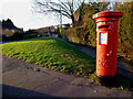
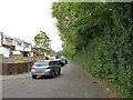
George VI Postbox
George VI 1936-1952.
The Postbox is in Moss Drive, Vange. Its identification number is SS16 272.
Looking towards the B1464 London Road.
Image: © terry joyce
Taken: 19 Jan 2012
0.13 miles
10
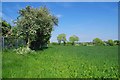
PROW 279-136
This 2.8 Km long Public Right of Way Joins Pitsea Station with Thurrock FP 199 at the boarder with the Unitary authority. Here it is running parallel with the Tilbury Loop of the LTS railway (operated by C2C).
Image: © Glyn Baker
Taken: 8 May 2020
0.15 miles