
IMAGES TAKEN NEAR TO
Woodgrange Drive, SOUTHEND-ON-SEA, SS1 3EL
Introduction
This page details the photographs taken nearby to Woodgrange Drive, SS1 3EL by members of the Geograph project.
The Geograph project started in 2005 with the aim of publishing, organising and preserving representative images for every square kilometre of Great Britain, Ireland and the Isle of Man.

There are currently over 7.5m images from over14,400 individuals and you can help contribute to the project by visiting https://www.geograph.org.uk
Image Map
Images are licensed for reuse under creativecommons.org/licenses/by-sa/2.0
Notes
- Clicking on the map will re-center to the selected point.
- The higher the marker number, the further away the image location is from the centre of the postcode.
Image Listing (16 Images Found)
Images are licensed for reuse under creativecommons.org/licenses/by-sa/2.0
Image
Details
Distance
1
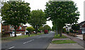
East end of Woodgrange Drive, Southend
Taken from the corner of Wyatts Drive.
Image: © David Kemp
Taken: 30 Apr 2020
0.04 miles
2
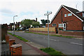
Wyatts Drive, Southend
The house whose side elevation can be seen on the right is in Woodgrange Drive.
Image: © David Kemp
Taken: 30 Apr 2020
0.11 miles
3
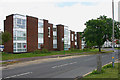
The Crispins, Thorpe Hall Avenue, Southend
The Crispins comprises flats situated in Thorpe Hall Avenue at the corner of Woodgrange Drive. The bus stop serves Arriva routes 7 and 8 on their long haul across south-east Essex from Rayleigh Station to Landwick.
Image: © David Kemp
Taken: 30 Apr 2020
0.12 miles
4
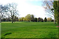
Thorpe Hall golf course
Taken from the public footpath through the course
Image: © william
Taken: 22 Mar 2009
0.13 miles
5
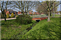
Watercourse in Willingale Way, Thorpe Bay
I am not certain whether the watercourse seen here that divides the two carriageways of Willingale Way is a man-made drainage channel or a canalised stream.
Image: © David Kemp
Taken: 15 Apr 2019
0.13 miles
6
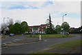
Roundabout at junction of Woodgrange Drive & Thorpe Hall Avenue
Image: © David Kemp
Taken: 30 Apr 2020
0.13 miles
7
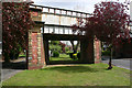
Former tramway arch in Thorpe Hall Avenue
The bridge carries the former London, Tilbury & Southend railway towards Thorpe Bay and Shoeburyness. Its present structure post-dates the railway, the bridge having been reconstructed in 1913 in conjunction with Southend Corporation's tramway boulevards project which added a second tram route to Thorpe Bay by way of the newly-created Southchurch and Thorpe Boulevards. However the boulevards ceased to carry trams in 1938 and today one can walk under the central arch of the bridge through which they used to run.
Image: © David Kemp
Taken: 30 Apr 2020
0.16 miles
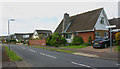
9
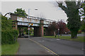
Railway bridge, Thorpe Hall Avenue
The bridge carries the former London, Tilbury & Southend railway towards Thorpe Bay and Shoeburyness. Its present structure post-dates the railway, the bridge having been reconstructed in 1913 in conjunction with Southend Corporation's tramway boulevards project which added a second tram route to Thorpe Bay by way of the newly-created Southchurch and Thorpe Boulevards. However the boulevards ceased to carry trams in 1938 and today one can walk under the central arch of the bridge through which they used to run.
Image: © David Kemp
Taken: 30 Apr 2020
0.17 miles
10
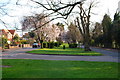
Thorpe Hall avenue
The central reservation used to carry tramlines.It now caters for dog walkers
Image: © william
Taken: 22 Mar 2009
0.21 miles