
IMAGES TAKEN NEAR TO
Woodgrange Drive, SOUTHEND-ON-SEA, SS1 3DZ
Introduction
This page details the photographs taken nearby to Woodgrange Drive, SS1 3DZ by members of the Geograph project.
The Geograph project started in 2005 with the aim of publishing, organising and preserving representative images for every square kilometre of Great Britain, Ireland and the Isle of Man.

There are currently over 7.5m images from over14,400 individuals and you can help contribute to the project by visiting https://www.geograph.org.uk
Image Map
Images are licensed for reuse under creativecommons.org/licenses/by-sa/2.0
Notes
- Clicking on the map will re-center to the selected point.
- The higher the marker number, the further away the image location is from the centre of the postcode.
Image Listing (15 Images Found)
Images are licensed for reuse under creativecommons.org/licenses/by-sa/2.0
Image
Details
Distance
1
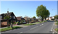
Woodgrange Drive, Southend
Taken from near the corner of Chelsworth Crescent.
Image: © David Kemp
Taken: 22 Apr 2020
0.13 miles
2
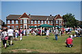
Back to school
Thorpe Greenways school summer fete.
Image: © william
Taken: 26 Jun 2010
0.15 miles
3
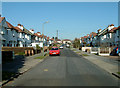
Southend-on-Sea: Rutland Avenue north of Woodgrange Drive looking North
These properties are typical of the eastward expansion of Southend-on-Sea in the late 1920s. Most houses are semi-detached and 3 or four bedrooms. There are a couple of detached properties and some bungalows towards the top of the road on the left. Many of these homes were built by local builder Thorby and benefit from large rear gardens of 60-80 feet in length and parking to the front.
Image: © Trevor Durritt
Taken: 17 Feb 2008
0.20 miles
4
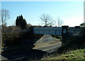
Southend-on-Sea: Lifstan Way Railway Bridge looking Southeast
This railway bridge carries the line from Shoeburyness to London Fenchurch Street.
Image: © Trevor Durritt
Taken: 17 Feb 2008
0.20 miles
5
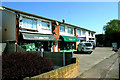
Shopping parade, Woodgrange Drive, Southend
This is the shopping parade opposite Chelsworth Crescent.
Image: © David Kemp
Taken: 22 Apr 2020
0.20 miles
6
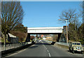
Southend-on-Sea: Lifstan Way Railway Bridge looking North
This railway bridge carries the line from Shoeburyness to London Fenchurch Street.
Image: © Trevor Durritt
Taken: 17 Feb 2008
0.21 miles
8
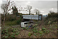
The London, Tilbury and Southend Railway crossing Lifstan Way
Image: © Roger A Smith
Taken: 23 Feb 2017
0.21 miles
9
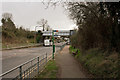
The London, Tilbury and Southend Railway crossing Lifstan Way
Image: © Roger A Smith
Taken: 23 Feb 2017
0.21 miles
10
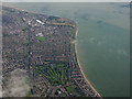
Shoebury Ness from the air
Thorpe Hall golf club is in the foreground, with Southend-on-Sea on the Thames estuary spreading out beyond.
Image: © Thomas Nugent
Taken: 14 Sep 2015
0.23 miles