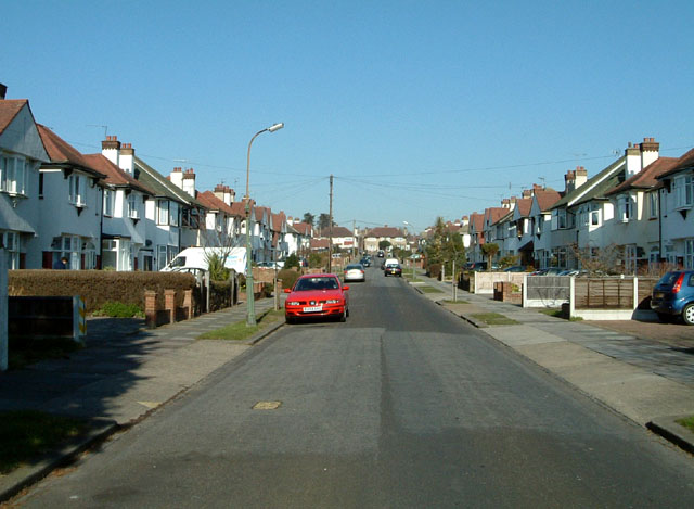
Southend-on-Sea: Rutland Avenue north of Woodgrange Drive looking North
Introduction
The photograph on this page of Southend-on-Sea: Rutland Avenue north of Woodgrange Drive looking North by Trevor Durritt as part of the Geograph project.
The Geograph project started in 2005 with the aim of publishing, organising and preserving representative images for every square kilometre of Great Britain, Ireland and the Isle of Man.
There are currently over 7.5m images from over 14,400 individuals and you can help contribute to the project by visiting https://www.geograph.org.uk

Image: © Trevor Durritt Taken: 17 Feb 2008
These properties are typical of the eastward expansion of Southend-on-Sea in the late 1920s. Most houses are semi-detached and 3 or four bedrooms. There are a couple of detached properties and some bungalows towards the top of the road on the left. Many of these homes were built by local builder Thorby and benefit from large rear gardens of 60-80 feet in length and parking to the front.

