IMAGES TAKEN NEAR TO
Butterys, SOUTHEND-ON-SEA, SS1 3DT

Introduction

This page details the photographs taken nearby to Butterys, SS1 3DT by members of the Geograph project.

The Geograph project started in 2005 with the aim of publishing, organising and preserving representative images for every square kilometre of Great Britain, Ireland and the Isle of Man.

There are currently over 7.5m images from over14,400 individuals and you can help contribute to the project by visiting https://www.geograph.org.uk

Image Map


Images are licensed for reuse under creativecommons.org/licenses/by-sa/2.0
Notes
  • Clicking on the map will re-center to the selected point.
  • The higher the marker number, the further away the image location is from the centre of the postcode.

Image Listing (44 Images Found)

Images are licensed for reuse under creativecommons.org/licenses/by-sa/2.0
  • ...
Image
Details
Distance
1
Southend-on-Sea: Lifstan Way Railway Bridge looking Southeast
This railway bridge carries the line from Shoeburyness to London Fenchurch Street.
Image: © Trevor Durritt Taken: 17 Feb 2008
0.09 miles
2
Southend-on-Sea: Lifstan Way Railway Bridge looking North
This railway bridge carries the line from Shoeburyness to London Fenchurch Street.
Image: © Trevor Durritt Taken: 17 Feb 2008
0.09 miles
3
The London, Tilbury and Southend Railway crossing Lifstan Way
Image: © Roger A Smith Taken: 23 Feb 2017
0.09 miles
4
The London, Tilbury and Southend Railway crossing Lifstan Way
Image: © Roger A Smith Taken: 23 Feb 2017
0.09 miles
5
Southend-on-Sea: Woodgrange Close Level Crossing looking West to Southend East Station 2008
This is a view from a pedestrian level crossing looking west. The line is the railway between London Fenchurch Street and Shoeburyness. We are looking towards Fenchurch Street. The bridge just visible in the distance is part of Southend East station. On a safety note, the photograph was taken on a day when there were no trains running because of engineering works.
Image: © Trevor Durritt Taken: 2 Mar 2008
0.12 miles
6
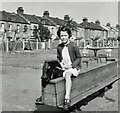
An old traction engine in a park behind Dalmatia Road, Southchurch in 1959
Image: © Antony Ewart Smith Taken: 1 Aug 1959
0.13 miles
7
The rear of houses on Dalmatia Road, Southchurch in 1959
See also: Image
Image: © A.C.Burgess Taken: 1 Aug 1959
0.14 miles
8
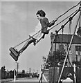
A playground at the end of Riviera Drive in 1959
Image: © A.C.Burgess Taken: 1 Aug 1959
0.14 miles
9
The rear of houses on Dalmatia Road, Southchurch in 2017
Work is being carried out improving sewage & drainage facilities. See also: Image
Image: © Roger A Smith Taken: 23 Feb 2017
0.16 miles
10
Southend-on-Sea: Rutland Avenue north of Woodgrange Drive looking North
These properties are typical of the eastward expansion of Southend-on-Sea in the late 1920s. Most houses are semi-detached and 3 or four bedrooms. There are a couple of detached properties and some bungalows towards the top of the road on the left. Many of these homes were built by local builder Thorby and benefit from large rear gardens of 60-80 feet in length and parking to the front.
Image: © Trevor Durritt Taken: 17 Feb 2008
0.16 miles
  • ...