IMAGES TAKEN NEAR TO
Lords Way, BASILDON, SS13 1TN
Introduction
This page details the photographs taken nearby to Lords Way, SS13 1TN by members of the Geograph project.
The Geograph project started in 2005 with the aim of publishing, organising and preserving representative images for every square kilometre of Great Britain, Ireland and the Isle of Man.

There are currently over 7.5m images from over14,400 individuals and you can help contribute to the project by visiting https://www.geograph.org.uk
Image Map
Images are licensed for reuse under creativecommons.org/licenses/by-sa/2.0
Notes
- Clicking on the map will re-center to the selected point.
- The higher the marker number, the further away the image location is from the centre of the postcode.
Image Listing (11 Images Found)
Images are licensed for reuse under creativecommons.org/licenses/by-sa/2.0
Image
Details
Distance
1
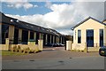
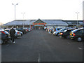
Offices, Cricketers' Way, Nevendon
These modern offices are built on the site of the former Cricketers' public house. It was originally on the corner of Nevendon Road and the Southend Arterial (A127) where traffic lights used to cause massive hold-ups. When the flyover was built the pub found itself on the slip road off the A127, and finally closed and was demolished a few years ago.
Image: © Trevor Harris
Taken: 16 Oct 2008
0.03 miles
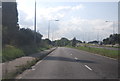
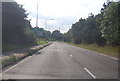
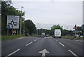
3
The A127, Nevendon
This is the main road from East London to Southend, now a full dual carriageway for the whole length.
Image: © David Howard
Taken: 24 May 2012
0.11 miles
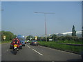
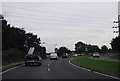
4
The A132 exit on Southend Arterial Road
Image: © David Howard
Taken: 8 Apr 2019
0.13 miles
7
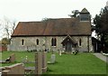
St. Peter; the parish church of old Nevendon
This small church is mainly 13th to 15th century and is located in Basildon new town. Nevendon is one of a handful of villages that was swallowed up by the new town and it is not easy to imagine what the original village looked like. An 18th century map shows that the village did indeed surround this church but modern maps now show Nevendon a good distance east of this church. Judging by the neat and tidy graveyard it is still a church that is loved and cared for, which is good to know.
Image: © Robert Edwards
Taken: 9 Apr 2008
0.20 miles
8
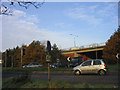
Nevendon Flyover, Basildon
At junction of A127 and A132
Image: © John Winfield
Taken: 9 Dec 2005
0.20 miles
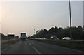
10
A132, near the end of the dual carriageway
Image: © N Chadwick
Taken: 20 Aug 2012
0.24 miles