
IMAGES TAKEN NEAR TO
Victoria Avenue, WICKFORD, SS12 0DL
Introduction
This page details the photographs taken nearby to Victoria Avenue, SS12 0DL by members of the Geograph project.
The Geograph project started in 2005 with the aim of publishing, organising and preserving representative images for every square kilometre of Great Britain, Ireland and the Isle of Man.

There are currently over 7.5m images from over14,400 individuals and you can help contribute to the project by visiting https://www.geograph.org.uk
Image Map
Images are licensed for reuse under creativecommons.org/licenses/by-sa/2.0
Notes
- Clicking on the map will re-center to the selected point.
- The higher the marker number, the further away the image location is from the centre of the postcode.
Image Listing (6 Images Found)
Images are licensed for reuse under creativecommons.org/licenses/by-sa/2.0
Image
Details
Distance
1
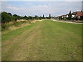
River Crouch valley
The River Crouch flows downstream in the rough grass to the left. Riverside Walk is the road to the right. A comparison between the 1940s Ordnance Survey map and the current map shows how much the former meanders in the river downstream of here have been removed to straighten the channel.
Image: © Nigel Cox
Taken: 15 Aug 2006
0.17 miles
3
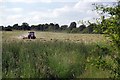
Making Hay in Wickford
This rural scene was five minutes walk from the centre of Wickford
Image: © Glyn Baker
Taken: 29 Jun 2013
0.18 miles
4

Footpath in Wickford
Not exactly the scene i was expecting to find in the middle of Wickford!
Image: © Glyn Baker
Taken: 29 Jun 2013
0.22 miles
5
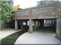
River Crouch in Wickford
This bridge carries the A129 London Road over the river. See Image for an explanation of the width of the concrete conduit that it is flowing in.
Image: © Nigel Cox
Taken: 15 Aug 2006
0.23 miles
6
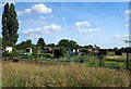
Wickford Allotments
Allotments located south of the railway line in Wickford.
Image: © Glyn Baker
Taken: 29 Jun 2013
0.23 miles