
IMAGES TAKEN NEAR TO
Fairfax Drive, WESTCLIFF-ON-SEA, SS0 9LZ
Introduction
This page details the photographs taken nearby to Fairfax Drive, SS0 9LZ by members of the Geograph project.
The Geograph project started in 2005 with the aim of publishing, organising and preserving representative images for every square kilometre of Great Britain, Ireland and the Isle of Man.

There are currently over 7.5m images from over14,400 individuals and you can help contribute to the project by visiting https://www.geograph.org.uk
Image Map
Images are licensed for reuse under creativecommons.org/licenses/by-sa/2.0
Notes
- Clicking on the map will re-center to the selected point.
- The higher the marker number, the further away the image location is from the centre of the postcode.
Image Listing (13 Images Found)
Images are licensed for reuse under creativecommons.org/licenses/by-sa/2.0
Image
Details
Distance
2
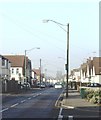
Fairfax Drive, Westcliff-on-Sea
This road runs through Westcliff along the valley of Prittle Brook Image Some of the lamp standards once carried the overhead wiring for the trolleybuses until the latter ceased operation in 1954. Fairfax Drive was on the West Circular route which had a service of twelve trolleybuses per hour in each direction Image Taken near Westcliff Park Drive looking west.
Image: © David Kemp
Taken: 28 Jan 2006
0.05 miles
3
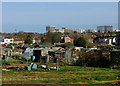
Prittlewell allotments
Part of a large area of allotments between Fairfax Drive and Prittlewell Chase. The high rise buildings of central Southend are in the distance.
Image: © John Allan
Taken: 16 Apr 2013
0.09 miles
4
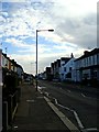
Fairfax Drive
Looking east from the junction with the footpath to the hospital
Image: © John Myers
Taken: 10 Oct 2014
0.13 miles
5
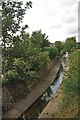
The Prittle Brook
A heavily canalised stream
Image: © Glyn Baker
Taken: 13 Aug 2011
0.15 miles
6
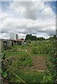
Allotments by the Prittlewell Brook
These allotments are sandwiched between Fairfax Rd and Prittlewell Chase
Image: © Glyn Baker
Taken: 13 Aug 2011
0.16 miles
7
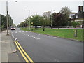
Prittlewell Chase, Prittlewell, Southend
The Entrance to the hospital is on the right.
Image: © Julian P Guffogg
Taken: 11 Oct 2012
0.17 miles
8
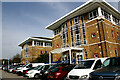
Cardigan Building, Southend Hospital
One of the older buildings at the hospital which was opened on this site in 1932 and much expanded and modified thereafter.
Image: © David Kemp
Taken: 31 Mar 2021
0.18 miles
9
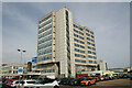
Tower Block, Southend Hospital
The Tower Block opened in 1971. The Accident & Emergency facility is on the far left.
Image: © David Kemp
Taken: 31 Mar 2021
0.18 miles
10
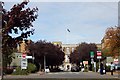
Southend Hospital Entrance
Before the building of the tower block, which now incorporates the main entrance, this entry facing Prittlewell Chase, was the main way in to the hospital.
Image: © Trevor Harris
Taken: 2 Oct 2009
0.20 miles