
IMAGES TAKEN NEAR TO
Chalkwell Avenue, WESTCLIFF-ON-SEA, SS0 8HN
Introduction
This page details the photographs taken nearby to Chalkwell Avenue, SS0 8HN by members of the Geograph project.
The Geograph project started in 2005 with the aim of publishing, organising and preserving representative images for every square kilometre of Great Britain, Ireland and the Isle of Man.

There are currently over 7.5m images from over14,400 individuals and you can help contribute to the project by visiting https://www.geograph.org.uk
Image Map
Images are licensed for reuse under creativecommons.org/licenses/by-sa/2.0
Notes
- Clicking on the map will re-center to the selected point.
- The higher the marker number, the further away the image location is from the centre of the postcode.
Image Listing (70 Images Found)
Images are licensed for reuse under creativecommons.org/licenses/by-sa/2.0
Image
Details
Distance
1
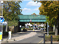
Railway bridge FSS2 231 over Chalkwell Avenue
Unusually not properly plated, the only street level identification appears to be a stencilled '231' on the abutments. 14'-6" signed clearance.
Image: © Robin Webster
Taken: 1 Oct 2018
0.06 miles
2
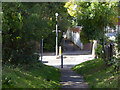
Victory Path crosses Chalkwell Avenue
The path runs between The Ridgeway in the west and Britannia Road in the east, closely parallel to the railway.
Image: © Robin Webster
Taken: 1 Oct 2018
0.07 miles
4
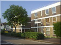
Flats on Chalkwell Avenue
I would date these late 60s/early 70s
Image: © David Howard
Taken: 24 May 2012
0.09 miles
5
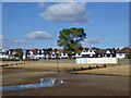
Chalkwell Esplanade
A fine tree for a seafront position.
Image: © Robin Webster
Taken: 1 Oct 2018
0.10 miles
6
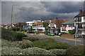
Chalkwell Esplanade
A series of very individual villas overlook the seafront along Chalkwell Esplanade. The sun is shining on them but the clouds look threatening.
Image: © Stephen McKay
Taken: 27 Aug 2011
0.11 miles
9
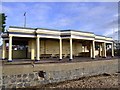
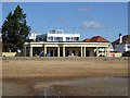
Sun shelter
I don't know much about it. It is on the seawall behind the Crowstone. It looks Art Deco-ish and is full of graffiti.
Image: © Julieanne Savage
Taken: 20 Jan 2007
0.11 miles
10
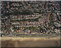
Aerial view of Southend seafront: Chalkwell Esplanade
The shelter just behind the beach on the left marks the end (or beginning) of the Esplanade as a main road (going on to Shoebury). The road from the shelter running along the left is Chalkwell Avenue, which reaches the A13 (London Road) at Chalkwell Park.
The previous (eastern) photo in this sequence is Image The next (western) photo is Image
Image: © Edward Clack
Taken: 26 May 1988
0.12 miles