
IMAGES TAKEN NEAR TO
North Road, WESTCLIFF-ON-SEA, SS0 7AH
Introduction
This page details the photographs taken nearby to North Road, SS0 7AH by members of the Geograph project.
The Geograph project started in 2005 with the aim of publishing, organising and preserving representative images for every square kilometre of Great Britain, Ireland and the Isle of Man.

There are currently over 7.5m images from over14,400 individuals and you can help contribute to the project by visiting https://www.geograph.org.uk
Image Map
Images are licensed for reuse under creativecommons.org/licenses/by-sa/2.0
Notes
- Clicking on the map will re-center to the selected point.
- The higher the marker number, the further away the image location is from the centre of the postcode.
Image Listing (15 Images Found)
Images are licensed for reuse under creativecommons.org/licenses/by-sa/2.0
Image
Details
Distance
1
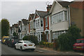
Cliff Avenue, Westcliff-on-Sea
Cliff Avenue is one of a number of late C19 to early C20 terraced streets that lie in the triangle defined by London Road, West Road and Victoria Avenue. The homely nature of this area became somewhat diminished with the construction of the nearby Balmoral Complex and its three tower blocks in 1971.
Image: © David Kemp
Taken: 25 Oct 2016
0.03 miles
2
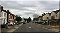
North Road, Westcliff
Taken from outside the North Road Primary Care Centre looking south. The building in the background is Blackdown, one of four tower blocks.
Image: © David Kemp
Taken: 4 Sep 2020
0.04 miles
3
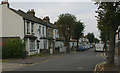
Salisbury Avenue, Westcliff-on-Sea
Taken from near the junction with Cliff Avenue (right).
Image: © David Kemp
Taken: 25 Oct 2016
0.07 miles
4
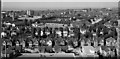
North Road Burial Ground and surrounding area in the 50's
This photograph was taken from a building near to the railway terminus. The date is approximate.
Image: © Antony Ewart Smith
Taken: Unknown
0.08 miles
5
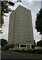
Blackdown, North Road, Westcliff-on-Sea
Blackdown is one of the three tower blocks that form the Balmoral Complex and dates from 1971. The others are Grampian and Brecon. The estate stands on the site of Campbell Road, Eastwick Road and Newlands Road all of whose terraced houses were demolished for the purpose.
Image: © David Kemp
Taken: 25 Oct 2016
0.08 miles
6
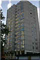
Brecon, Salisbury Avenue, Westcliff-on-Sea
Brecon is one of the three tower blocks that form the Balmoral Complex and dates from 1971. The others are Grampian and Blackdown. The estate stands on the site of Campbell Road, Eastwick Road and Newlands Road all of whose terraced houses were demolished for the purpose.
Image: © David Kemp
Taken: 26 Oct 2016
0.09 miles
7
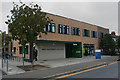
North Road Primary Care Centre, Westcliff
A branch of Southend University Hospital and situated at 183-95 North Road, it first opened in 2013.
Image: © David Kemp
Taken: 4 Sep 2020
0.10 miles
8
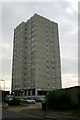
Grampian, Balmoral Road, Westcliff-on-Sea (1)
Grampian is one of three tower blocks comprising the Balmoral Complex completed in 1971. Its eastern side faces Salisbury Avenue from which this shot was taken. The other blocks are Blackdown and Brecon. The estate stands on the site of Campbell Road, Eastwick Road and Newlands Road all of whose terraced houses were demolished for the purpose.
Image: © David Kemp
Taken: 25 Oct 2016
0.10 miles
9

Grampian, Balmoral Road, Westcliff-on-Sea (2)
This is the front, south-western elevation of the block. Its other side faces Salisbury Avenue.
Image: © David Kemp
Taken: 26 Oct 2016
0.12 miles
10
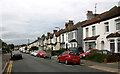
North Road, Westcliff - east side
Taken from the North Road Primary Care Centre.
Image: © David Kemp
Taken: 4 Sep 2020
0.12 miles