IMAGES TAKEN NEAR TO
Seaton, SEAHAM, SR7 0NN
Introduction
This page details the photographs taken nearby to SR7 0NN by members of the Geograph project.
The Geograph project started in 2005 with the aim of publishing, organising and preserving representative images for every square kilometre of Great Britain, Ireland and the Isle of Man.

There are currently over 7.5m images from over14,400 individuals and you can help contribute to the project by visiting https://www.geograph.org.uk
Image Map
Images are licensed for reuse under creativecommons.org/licenses/by-sa/2.0
Notes
- Clicking on the map will re-center to the selected point.
- The higher the marker number, the further away the image location is from the centre of the postcode.
Image Listing (10 Images Found)
Images are licensed for reuse under creativecommons.org/licenses/by-sa/2.0
Image
Details
Distance
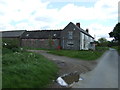
3
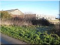
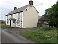
Barns at High Sharpley
On Salter's Lane.
Image: © Oliver Dixon
Taken: 16 Jan 2007
0.02 miles
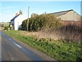
6
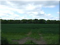
Crop field, High Sharpley
West of National Cycle Route 70.
Image: © JThomas
Taken: 28 May 2015
0.09 miles
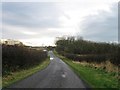
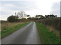
7
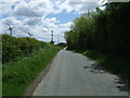
National Cycle Route 70
Heading south east near High Sharpley.
Image: © JThomas
Taken: 28 May 2015
0.15 miles
8
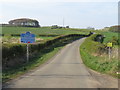
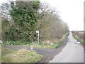
County boundary on Salter's Lane, near Seaham
The blue sign marks the point where Salter's Lane crosses from County Durham into the county of Tyne & Wear.
Salter's Lane is on the route of the Walney-to-Wear (W2W) long-distance cycle route.
Image: © Malc McDonald
Taken: 21 Apr 2019
0.19 miles