IMAGES TAKEN NEAR TO
Lutterworth Road, SUNDERLAND, SR2 9AZ
Introduction
This page details the photographs taken nearby to Lutterworth Road, SR2 9AZ by members of the Geograph project.
The Geograph project started in 2005 with the aim of publishing, organising and preserving representative images for every square kilometre of Great Britain, Ireland and the Isle of Man.

There are currently over 7.5m images from over14,400 individuals and you can help contribute to the project by visiting https://www.geograph.org.uk
Image Map
Images are licensed for reuse under creativecommons.org/licenses/by-sa/2.0
Notes
- Clicking on the map will re-center to the selected point.
- The higher the marker number, the further away the image location is from the centre of the postcode.
Image Listing (26 Images Found)
Images are licensed for reuse under creativecommons.org/licenses/by-sa/2.0
Image
Details
Distance
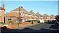
1
Loughborough Avenue, Sunderland
This image was taken late in the afternoon, with sunlight catching the leaves.
Image: © Malc McDonald
Taken: 18 Apr 2014
0.09 miles
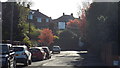
3
Larkfield Road, Sunderland
Long shadows give a clue that this image was taken in the early evening.
Image: © Malc McDonald
Taken: 19 Apr 2014
0.12 miles
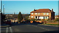
4
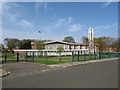
Church of Jesus Christ of Latter-day Saints, Sunderland
The Church of Jesus Christ of Latter-day Saints is a strand of Christian religion also known as the Mormon church. This image shows the Mormon church building in Sunderland.
Image: © Malc McDonald
Taken: 21 Apr 2019
0.12 miles
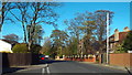
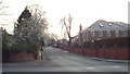
6
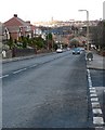
Tunstall Road
In the Hillview area of Sunderland.
Image: © Chris Tweedy
Taken: 26 Jan 2006
0.13 miles
7

Church of Jesus Christ of Latter-Day Saints
Striking modern church in Linden Road.
Image: © Oliver Dixon
Taken: 15 Nov 2016
0.14 miles
8
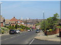
Tunstall Road, Sunderland
Tunstall Road in Sunderland, looking north towards the city centre.
Image: © Malc McDonald
Taken: 21 Apr 2019
0.14 miles
9
Tunstall Road, Sunderland
Tunstall Road, looking north towards the centre of Sunderland.
This image was taken in the early evening, as shadows were getting long.
Image: © Malc McDonald
Taken: 19 Apr 2014
0.15 miles
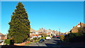
10
Ashbrooke Range, Sunderland
This image was taken during the late afternoon on an early March day, as the sun was about to set. Spring blossom has started to appear on the trees.
Image: © Malc McDonald
Taken: 8 Mar 2014
0.15 miles