IMAGES TAKEN NEAR TO
Stockton Road, SUNDERLAND, SR1 3NR
Introduction
This page details the photographs taken nearby to Stockton Road, SR1 3NR by members of the Geograph project.
The Geograph project started in 2005 with the aim of publishing, organising and preserving representative images for every square kilometre of Great Britain, Ireland and the Isle of Man.

There are currently over 7.5m images from over14,400 individuals and you can help contribute to the project by visiting https://www.geograph.org.uk
Image Map
Images are licensed for reuse under creativecommons.org/licenses/by-sa/2.0
Notes
- Clicking on the map will re-center to the selected point.
- The higher the marker number, the further away the image location is from the centre of the postcode.
Image Listing (59 Images Found)
Images are licensed for reuse under creativecommons.org/licenses/by-sa/2.0
Image
Details
Distance
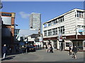
1
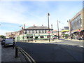
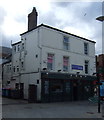
Chaplins bar
City centre pub on Stockton Road, Sunderland.
Image: © Robert Graham
Taken: 3 Oct 2016
0.02 miles
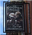
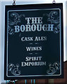
2
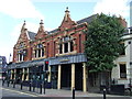
The Cooper Rose
A Wetherspoon pub on Albion Place.
Image: © JThomas
Taken: 28 May 2015
0.03 miles
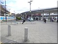
4
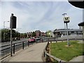
Entrance to Park Lane Bus Station
The main bus station for Sunderland city centre, it also incorporates a metro station. Pictured from Stockton Road.
Image: © Robert Graham
Taken: 26 Jun 2013
0.06 miles
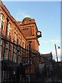
7
Park Lane Interchange
This handsome bus and coach station built in 1999 is allegedly the busiest bus station in Britain outside London. It adjoins a station on the Tyne and Wear Metro.
Image: © Oliver Dixon
Taken: 23 Feb 2016
0.08 miles
9
Crowtree Road, Sunderland
Crowtree Road in the centre of Sunderland.
Image: © Malc McDonald
Taken: 30 Mar 2013
0.09 miles
10
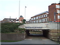
Pedestrian subway, Sunderland
This subway enables pedestrians and cyclists to pass beneath St. Michael's Way, a busy dual-carriageway in the centre of Sunderland. The University of Sunderland's Priestman Building is across the road.
Image: © Malc McDonald
Taken: 31 Mar 2013
0.11 miles