IMAGES TAKEN NEAR TO
Moor Close, SUNDERLAND, SR1 2JQ
Introduction
This page details the photographs taken nearby to Moor Close, SR1 2JQ by members of the Geograph project.
The Geograph project started in 2005 with the aim of publishing, organising and preserving representative images for every square kilometre of Great Britain, Ireland and the Isle of Man.

There are currently over 7.5m images from over14,400 individuals and you can help contribute to the project by visiting https://www.geograph.org.uk
Image Map
Images are licensed for reuse under creativecommons.org/licenses/by-sa/2.0
Notes
- Clicking on the map will re-center to the selected point.
- The higher the marker number, the further away the image location is from the centre of the postcode.
Image Listing (40 Images Found)
Images are licensed for reuse under creativecommons.org/licenses/by-sa/2.0
Image
Details
Distance
2
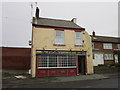
The Excelstor public house
On Lawrence Street, Sunderland.
Image: © Ian S
Taken: 3 Feb 2013
0.03 miles
3
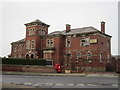
The Old Orphanage
In Hendon, Sunderland. Built in 1861 for boys of men lost at sea.
Image: © Robert Graham
Taken: 17 Oct 2016
0.05 miles
4
The East Community Centre
On Moor Terrace, Sunderland
Image: © Ian S
Taken: 3 Feb 2013
0.05 miles
6
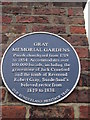
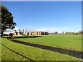
Town Moor, Sunderland
The England Coast Path National Trail passes through this green space in the north-east of the City. The interpretive board gives an account of the hardships sustained by the inhabitants in the 19th century. It also tells the tale of Mary Ann Cotton who made a business out of murdering 16 members of her family and three others with arsenic and did quite nicely by collecting the insurance money. She was eventually found out and was hanged in 1873.
Image: © Oliver Dixon
Taken: 23 Feb 2016
0.08 miles
7
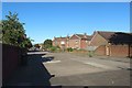
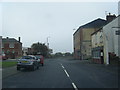
Cousin Street, Sunderland
A residential street in Sunderland in an area of houses between the city centre and the port.
Image: © Graham Robson
Taken: 12 Jul 2018
0.09 miles
8
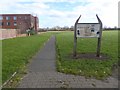
Sunderland Town Moor
View from the south near Moor Terrace of this survivor of the original town of Sunderland, now a public park.
Image: © Robert Graham
Taken: 17 Oct 2016
0.10 miles
9
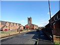
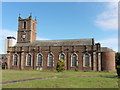
Holy Trinity Church, Sunderland
View from the west on Coronation Street. The church was built in 1719 and is a rare example of an early Georgian church. When built, it was in the centre of the town, but in the later 18 and 19 centuries, the centre shifted to the west, leaving the church in the eastern suburbs.
Image: © Robert Graham
Taken: 17 Oct 2016
0.11 miles