
IMAGES TAKEN NEAR TO
Anglers Road, SP8 4YR
Introduction
This page details the photographs taken nearby to Anglers Road, SP8 4YR by members of the Geograph project.
The Geograph project started in 2005 with the aim of publishing, organising and preserving representative images for every square kilometre of Great Britain, Ireland and the Isle of Man.

There are currently over 7.5m images from over14,400 individuals and you can help contribute to the project by visiting https://www.geograph.org.uk
Image Map
Images are licensed for reuse under creativecommons.org/licenses/by-sa/2.0
Notes
- Clicking on the map will re-center to the selected point.
- The higher the marker number, the further away the image location is from the centre of the postcode.
Image Listing (16 Images Found)
Images are licensed for reuse under creativecommons.org/licenses/by-sa/2.0
Image
Details
Distance
1
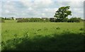
Field by the Lodden
Looking in the opposite direction from the same spot as Image Footpath N64 34 heads towards left of centre and the housing on the southern edge of Gillingham - see also Image
Image: © Derek Harper
Taken: 26 May 2016
0.04 miles
2
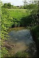
River Lodden
From just across the footbridge shown in Image the river is fliwing to the left. The modern houses are on Wren Place.
Image: © Derek Harper
Taken: 26 May 2016
0.07 miles
3
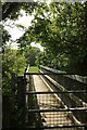
Bridge over the Lodden
This footbridge carries footpath N64 34 across the small river.
Image: © Derek Harper
Taken: 26 May 2016
0.08 miles
4
River Lodden
Image: © Derek Harper
Taken: 26 May 2016
0.09 miles
5
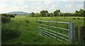
Field near Gillingham
From footpath N64 34 as it enters farmland near housing on The Meadows. The hill is Duncliffe Hill.
Image: © Derek Harper
Taken: 26 May 2016
0.11 miles
6
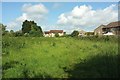
Path approaching Gillingham
Footpath N64 34 runs across this meadow. The houses on the right are on The Meadows; straight ahead is Meadowcroft. It's meadows all the way!
Image: © Derek Harper
Taken: 26 May 2016
0.13 miles
7
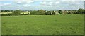
Line of path to Gillingham
Footpath N64 34 runs across this field towards the River Lodden. Beyond are the outskirts of Gillingham.
Image: © Derek Harper
Taken: 26 May 2016
0.15 miles
8
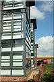
Nexus Apartments, Gillingham
Footpath N64 34 runs past the apartments also shown in Image], to reach the B3092 New Road.
Image: © Derek Harper
Taken: 26 May 2016
0.18 miles
9
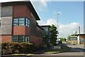
Nexus Apartments, Gillingham
On the B3092 New Road at the junction with Addison Close (left), and opposite
Image
Image: © Derek Harper
Taken: 26 May 2016
0.19 miles
10
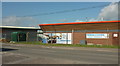
Olive Bowl, Gillingham
A function venue on the Brickfields Business Park, and seen here across the B3092.
Image: © Derek Harper
Taken: 26 May 2016
0.19 miles