1
Gillingham: postbox № SP8 128, Deane Avenue
This postbox stands on the corner of Newton Close and is emptied finally at 5:15pm on weekdays and at 11:30am on Saturdays. Alongside are two drop boxes (see below).
Image: © Chris Downer
Taken: 18 Oct 2009
0.06 miles
2
Gillingham: postbox № SP8 127, Broad Robin
This Elizabeth II-reign postbox is set into the wall of
Image and is emptied finally at 5:45pm on weekdays and at 11:30am on Saturdays.
Image: © Chris Downer
Taken: 18 Oct 2009
0.07 miles
3
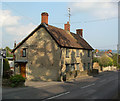
Gillingham: Wyke Post Office
Wyke Post Office used to be on Wyke Road (see
Image) but moved here, within the convenience store, about 10 years ago. It is in the curiously named road, Broad Robin. The three parking spaces facing us are reserved for occupants of the flats above.
Image: © Chris Downer
Taken: 18 Oct 2009
0.07 miles
4
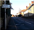
Kington Magna 3 miles to the left, Gillingham
The sign on the corner of Wyke Road points left (south) along Broad Robin.
Image: © Jaggery
Taken: 13 Dec 2014
0.08 miles
5
Sunlit houses and deep shadows on Wyke Road, Gillingham
Viewed just after 1pm in mid December. This is a typical scene on a sunny day in winter in the UK caused by the low elevation of the midday sun. This location is latitude 51 degrees north, which means that the noonday sun in midwinter is only about 16 degrees above the horizon compared with about 62 degrees in midsummer.
Image: © Jaggery
Taken: 13 Dec 2014
0.09 miles
6
Wincanton 6 miles ahead, Gillingham
Alongside the B3081 Wyke Road in Gillingham (Dorset) 6 miles from Wincanton (south Somerset).
Image: © Jaggery
Taken: 13 Dec 2014
0.10 miles
7
Old Toll House by the B3081, Wyke Road, Gillingham
Toll House by the B3081, in the parish of Gillingham (North Dorset District), The Old Toll House, Wyke Road, SP8 4NQ.
Grade II listed.
List Entry Number: 1324575 https://historicengland.org.uk/listing/the-list/list-entry/1324575
Surveyed
Milestone Society National ID: DO.GIL
Image: © Alan Rosevear
Taken: Unknown
0.10 miles
8
Wyke Road, Gillingham
Viewed from the edge of the Common Mead Lane junction, http://www.geograph.org.uk/photo/4290534 the point where
the B3081 Wyke Street behind the camera becomes the B3081 Wyke Road ahead.
Image: © Jaggery
Taken: 13 Dec 2014
0.10 miles
9
B3081 Wyke Road, Gillingham
The massive wall, apparently partly a retaining wall, is for the grounds of Knapp House and its outbuildings and cottages.
Image: © Robin Webster
Taken: 10 Jun 2018
0.11 miles
10
Gillingham houses [35]
Knapp House, glimpsed in the distance is 18th century with later extensions and alterations. Listed, grade II, with details at: https://historicengland.org.uk/listing/the-list/list-entry/1110311
Image: © Michael Dibb
Taken: 14 Feb 2019
0.12 miles


![Gillingham houses [35]](https://s1.geograph.org.uk/geophotos/06/08/66/6086649_d7407864_120x120.jpg)