
IMAGES TAKEN NEAR TO
Stourcastle Close, GILLINGHAM, SP8 4FH
Introduction
This page details the photographs taken nearby to Stourcastle Close, SP8 4FH by members of the Geograph project.
The Geograph project started in 2005 with the aim of publishing, organising and preserving representative images for every square kilometre of Great Britain, Ireland and the Isle of Man.

There are currently over 7.5m images from over14,400 individuals and you can help contribute to the project by visiting https://www.geograph.org.uk
Image Map
Images are licensed for reuse under creativecommons.org/licenses/by-sa/2.0
Notes
- Clicking on the map will re-center to the selected point.
- The higher the marker number, the further away the image location is from the centre of the postcode.
Image Listing (12 Images Found)
Images are licensed for reuse under creativecommons.org/licenses/by-sa/2.0
Image
Details
Distance
1
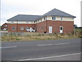
Peacemarsh surgery
A view looking west across the B3092 towards the Peacemarsh Surgery.
Image: © Phil Williams
Taken: 13 Aug 2006
0.02 miles
2
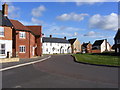
Tasteful Variations in Design.
Some of the rather nice designs on the estate at Peacemarsh, Gillingham.
Image: © Clive Warneford
Taken: 6 Feb 2008
0.06 miles
3
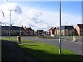
Peacemarsh Roundabout.
Taken from Gyllas Way, to the left is the road to the town centre of Gillingham, to the right is the road to Mere. New houses of tasteful design accessed opposite the photographer.
Image: © Clive Warneford
Taken: 6 Feb 2008
0.09 miles
4
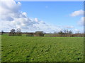
Unspoilt Views!
View across fields from new housing estate at Peacemarsh. A woodpecker could be heard in the distance.
Image: © Clive Warneford
Taken: 6 Feb 2008
0.10 miles
5
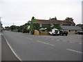
The Dolphin
A view looking north across the B3092 towards the Dolphin public house.
Image: © Phil Williams
Taken: 13 Aug 2006
0.12 miles
6
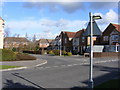
Entrance Road to Horsefields.
Estate built in the early 90's. Trees and Bushes were planted by the developer and these are now well established. The estate which is off Gyllas Way is within walking distance of the town centre and yet is only a short distance from open countryside.
Image: © Clive Warneford
Taken: 6 Feb 2008
0.14 miles
7
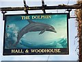
Sign for the Dolphin
Ancient seamen looked upon the dolphin as a creature who would help them in storms by twining itself around the anchor cable, thus preventing the anchor of dragging. The name has been used by ships of the Royal Navy from 1646 until the present day. Dolphins also figures in the coats of arms of the Fishmongers Company and the Company of Watermen and Lightermen. This is the sign for Image
Image: © Maigheach-gheal
Taken: 23 Nov 2008
0.15 miles
8
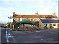
The Dolphin near Gillingham
Situated on the B3092 between Mere and Gillingham.
Image: © Maigheach-gheal
Taken: 23 Nov 2008
0.15 miles
9
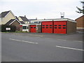
Gillingham Fire Station
A view looking to the southwest across the B3092 towards the Fire Station at Gillingham.
Image: © Phil Williams
Taken: 13 Aug 2006
0.18 miles
10
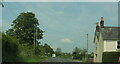
B3092 leaving Gillingham
On the right is The Old Fir Tree Inn: "Formerly a public house dating from the early 19th century, it was for many years the residence of the Light family who over several generations were the publicans. The building was owned by Matthews & Co Brewers of Gillingham and later owned by Hall and Woodhouse who held it until its closure in 1979" https://www.google.com/url?sa=t&source=web&rct=j&opi=89978449&url=https://moderngov.dorsetcouncil.gov.uk/Data/373/201709181400/Agenda/20170918%2520-%2520Colesbrook%2520-%2520Appendix%25203%2520(a)%2520Draft%2520Colesbrook%2520Conservation%2520Area%2520Report.pdf&ved=2ahUKEwi2--yIy5iHAxWyXUEAHSW2CJMQFnoECBkQAQ&usg=AOvVaw3D0nwtlC-GiVsFNl_Afrne .
Image: © Derek Harper
Taken: 7 May 2024
0.19 miles