
IMAGES TAKEN NEAR TO
Southampton Road, SALISBURY, SP5 3DG
Introduction
This page details the photographs taken nearby to Southampton Road, SP5 3DG by members of the Geograph project.
The Geograph project started in 2005 with the aim of publishing, organising and preserving representative images for every square kilometre of Great Britain, Ireland and the Isle of Man.

There are currently over 7.5m images from over14,400 individuals and you can help contribute to the project by visiting https://www.geograph.org.uk
Image Map
Images are licensed for reuse under creativecommons.org/licenses/by-sa/2.0
Notes
- Clicking on the map will re-center to the selected point.
- The higher the marker number, the further away the image location is from the centre of the postcode.
Image Listing (17 Images Found)
Images are licensed for reuse under creativecommons.org/licenses/by-sa/2.0
Image
Details
Distance
2
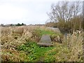
Britford, boardwalk
Across one of many ditches in the water meadows, draining into River Avon (to the right).
Image: © Mike Faherty
Taken: 14 Dec 2013
0.12 miles
3
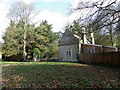
Lodge, Shute End
The lodge is beside one of the gates to Clarendon Park.
Image: © Maigheach-gheal
Taken: 5 Mar 2012
0.13 miles
4
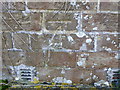
Bench Mark on the Lodge
The Ordnance Survey bench mark is to be found on the lodge shown in Image and for further information on the cut mark and others in the area http://www.bench-marks.org.uk/bm41745
Image: © Maigheach-gheal
Taken: 5 Mar 2012
0.13 miles
5
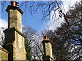
Chimneys on the Lodge
These chimneys are on the lodge shown in Image
Image: © Maigheach-gheal
Taken: 5 Mar 2012
0.13 miles
6
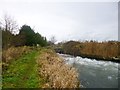
Britford, sluice
Controlling water input into River Avon; this sluice probably relates to Image
Image: © Mike Faherty
Taken: 14 Dec 2013
0.16 miles
7
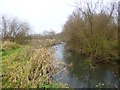
Britford, river branch
Looking upstream at a branch of River Avon. The branch has created Kitt's Island, to the right.
Image: © Mike Faherty
Taken: 14 Dec 2013
0.16 miles
8
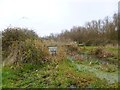
Britford, footbridge
A simple concrete bridge across an irrigation cannel in the water meadows: http://www.english-nature.org.uk/citation/citation_photo/1002342.pdf
Image: © Mike Faherty
Taken: 14 Dec 2013
0.18 miles
9
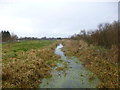
Britford, irrigation channel
Part of an extensive system of channels and ditches next to River Avon. Channels are fed by the river; fields were deliberately flooded in winter, to keep soil temperature warmer, and introduce river silt as fertiliser. The site is listed as SSSI: http://www.english-nature.org.uk/citation/citation_photo/1002342.pdf
Image: © Mike Faherty
Taken: 14 Dec 2013
0.18 miles
10
Approaching end of dual carriageway on A36
Image: © John Firth
Taken: 24 Oct 2015
0.20 miles