IMAGES TAKEN NEAR TO
Pepperbox Rise, SALISBURY, SP5 3BF

Introduction

This page details the photographs taken nearby to Pepperbox Rise, SP5 3BF by members of the Geograph project.

The Geograph project started in 2005 with the aim of publishing, organising and preserving representative images for every square kilometre of Great Britain, Ireland and the Isle of Man.

There are currently over 7.5m images from over14,400 individuals and you can help contribute to the project by visiting https://www.geograph.org.uk

Image Map


Images are licensed for reuse under creativecommons.org/licenses/by-sa/2.0
Notes
  • Clicking on the map will re-center to the selected point.
  • The higher the marker number, the further away the image location is from the centre of the postcode.

Image Listing (10 Images Found)

Images are licensed for reuse under creativecommons.org/licenses/by-sa/2.0
Image
Details
Distance
1
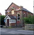
Primitive Methodist Chapel, Alderbury
The date stone gives the date of 1884.
Image: © Maigheach-gheal Taken: 14 Aug 2008
0.11 miles
2
Alderbury General Store
Image: © David Martin Taken: 29 May 2021
0.16 miles
3
Old Milestone by Southampton Road, Whaddon
Carved stone post by the UC road, in parish of ALDERBURY (SALISBURY District), Southampton Road, Whaddon; opposite the junction with Castle Lane, by bus stop near Post Office on verge, on East side of road. Southton plate, erected by the Sarum & Eling turnpike trust in the 19th century. Inscription reads:- SARUM 4½ SOUTHTON 18 Milestone Society National ID: WI_SASO04.
Image: © M Faherty Taken: 19 Jun 2007
0.17 miles
4
Alderbury & Whaddon Millennium Village Sign
Image: © Kyle Thompson Taken: 29 Dec 2005
0.19 miles
5
Alderbury and Whaddon Village Sign
Image: © Maigheach-gheal Taken: 14 Aug 2008
0.20 miles
6
Overbridge over A36 near Whaddon
Image: © John Firth Taken: 24 Oct 2015
0.21 miles
7
A36 bypassing Whaddon
The bridge carries the Whaddon - West Grimstead road.
Image: © Robin Webster Taken: 10 Jun 2018
0.21 miles
8
Alderbury and Whaddon Village Sign
Image: © Maigheach-gheal Taken: 14 Aug 2008
0.22 miles
9
Path past Matrons College Farm
Image: © David Martin Taken: 29 May 2021
0.23 miles
10
Lake at Alderbury
On the route of the former Salisbury and Southampton Canal.
Image: © David Martin Taken: 29 May 2021
0.25 miles