
IMAGES TAKEN NEAR TO
Dean Lane, SALISBURY, SP5 2RQ
Introduction
This page details the photographs taken nearby to Dean Lane, SP5 2RQ by members of the Geograph project.
The Geograph project started in 2005 with the aim of publishing, organising and preserving representative images for every square kilometre of Great Britain, Ireland and the Isle of Man.

There are currently over 7.5m images from over14,400 individuals and you can help contribute to the project by visiting https://www.geograph.org.uk
Image Map
Images are licensed for reuse under creativecommons.org/licenses/by-sa/2.0
Notes
- Clicking on the map will re-center to the selected point.
- The higher the marker number, the further away the image location is from the centre of the postcode.
Image Listing (129 Images Found)
Images are licensed for reuse under creativecommons.org/licenses/by-sa/2.0
Image
Details
Distance
2
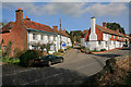
Dean Lane, Whiteparish
Seen from the church yard, looking across Romsey Road.
Image: © Peter Facey
Taken: 16 Mar 2007
0.02 miles
3
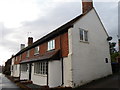
The Old White Hart, Whiteparish
The house was, in a former life the White Hart Inn. There is an Ordnance Survey flush bracket on the south east angle.
Image: © Maigheach-gheal
Taken: 27 Jan 2012
0.02 miles
5
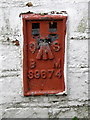
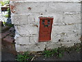
Flush Bracket S9674, Whiteparish
The Ordnance Survey flush bracket is to be found on the south east angle of the Old White Hart. For a view of the building Image and for further information on the bracket and others in the area http://www.bench-marks.org.uk/bm21653
Image: © Maigheach-gheal
Taken: 27 Jan 2012
0.03 miles
6
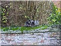
Watching the world go by, Whiteparish
A cat sits on this beautiful old brick wall watching us walk by.
Image: © Maigheach-gheal
Taken: 18 Nov 2008
0.03 miles
7
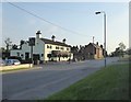
Whiteparish: the main village street
View south-westward. The pub is the 'Parish Lantern', the road is part of the A27.
Image: © Stefan Czapski
Taken: 6 Jun 2018
0.03 miles
8

Weather vane, Whiteparish
Weather vane on a cottage near the church.
Image: © Maigheach-gheal
Taken: 18 Nov 2008
0.03 miles
10
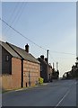
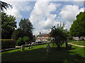
Whiteparish: red brick and flint
At the time of taking the photograph I assumed that the building with flintwork panels was some sort of converted mill or maltings. Examining the image on screen later, I have to say that the brickwork and roofing look so neat that I can only conclude that they are 'new build'. Good, anyway, that local traditions have been respected.
The view is south-west along the main village street - which also happens to be the A27.
Image: © Stefan Czapski
Taken: 6 Jun 2018
0.05 miles