IMAGES TAKEN NEAR TO
Cowesfield Green, SALISBURY, SP5 2QS
Introduction
This page details the photographs taken nearby to Cowesfield Green, SP5 2QS by members of the Geograph project.
The Geograph project started in 2005 with the aim of publishing, organising and preserving representative images for every square kilometre of Great Britain, Ireland and the Isle of Man.

There are currently over 7.5m images from over14,400 individuals and you can help contribute to the project by visiting https://www.geograph.org.uk
Image Map
Images are licensed for reuse under creativecommons.org/licenses/by-sa/2.0
Notes
- Clicking on the map will re-center to the selected point.
- The higher the marker number, the further away the image location is from the centre of the postcode.
Image Listing (12 Images Found)
Images are licensed for reuse under creativecommons.org/licenses/by-sa/2.0
Image
Details
Distance
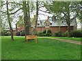
1
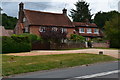
House opposite the end of Parkwater Road
Image: © David Martin
Taken: 14 Jul 2020
0.02 miles
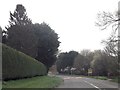
3
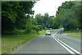
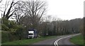
A27 towards Salisbury
Passing a garden centre at Cowesfield Green.
Image: © Robin Webster
Taken: 10 Jun 2018
0.10 miles
6
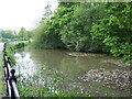
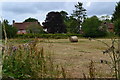
Roadside duck pond near Cowesfield Green
It would be a tranquil spot if it weren't right next to the A27
Image: © David Martin
Taken: 26 Apr 2007
0.12 miles
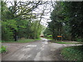
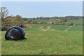
9
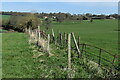
Remains of the path
The route of the path is variously obstructed by brambles and collapsed fences.
Image: © David Martin
Taken: 30 Mar 2021
0.19 miles