
IMAGES TAKEN NEAR TO
Coles Lane, SALISBURY, SP5 2DZ
Introduction
This page details the photographs taken nearby to Coles Lane, SP5 2DZ by members of the Geograph project.
The Geograph project started in 2005 with the aim of publishing, organising and preserving representative images for every square kilometre of Great Britain, Ireland and the Isle of Man.

There are currently over 7.5m images from over14,400 individuals and you can help contribute to the project by visiting https://www.geograph.org.uk
Image Map
Images are licensed for reuse under creativecommons.org/licenses/by-sa/2.0
Notes
- Clicking on the map will re-center to the selected point.
- The higher the marker number, the further away the image location is from the centre of the postcode.
Image Listing (4 Images Found)
Images are licensed for reuse under creativecommons.org/licenses/by-sa/2.0
Image
Details
Distance
1
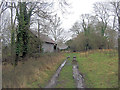
Witterns Hill Farm
The long narrow Coles's lane finally peters out into a muddy track. The whole shaped like a question mark in reverse, skirts the south eastern fringes of Langley Wood National Nature Reserve. The track culminates in this run down farm.
Image: © Stuart Logan
Taken: 29 Jan 2013
0.05 miles
2
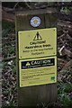
Just when you thought it was safe to go back into the woods...
Having just made it safely across a fairway on Hamptworth Golf Course, the walker is warned about the possibility of being caught up in deer shooting, or injured by the trees (precise hazard not specified!)
Image: © David Martin
Taken: 11 Apr 2021
0.11 miles
3

Footpath on the edge of Hamptworth golf course
Image: © David Martin
Taken: 17 Jan 2022
0.17 miles
