IMAGES TAKEN NEAR TO
West Winterslow, SALISBURY, SP5 1SB
Introduction
This page details the photographs taken nearby to SP5 1SB by members of the Geograph project.
The Geograph project started in 2005 with the aim of publishing, organising and preserving representative images for every square kilometre of Great Britain, Ireland and the Isle of Man.

There are currently over 7.5m images from over14,400 individuals and you can help contribute to the project by visiting https://www.geograph.org.uk
Image Map
Images are licensed for reuse under creativecommons.org/licenses/by-sa/2.0
Notes
- Clicking on the map will re-center to the selected point.
- The higher the marker number, the further away the image location is from the centre of the postcode.
Image Listing (11 Images Found)
Images are licensed for reuse under creativecommons.org/licenses/by-sa/2.0
Image
Details
Distance
2
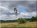
Windpump at Dunstable Corner
The windpump is used for pumping water.
Image: © Maigheach-gheal
Taken: 19 Jul 2008
0.07 miles
4
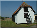
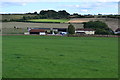
Fjordling Smokehouse
This smokehouse can be found at Dunstable Farm, West Winterslow, Salisbury. The outhouse shown is typical of this Wiltshire valley.
Image: © Stuart Buchan
Taken: 20 Jul 2006
0.10 miles
5
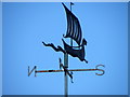
Weather vane, Dunstable Farm
The weather vane is to be found on the corner of the farm buildings. The farm buildings cross the gridline.
On their ships, the Vikings replaced their fabric flags with flat metal quadrant weathervanes (9th century), giving clues to the origin of the word 'weathervane'. The word 'vane' (formerly spelt fane) means pennon or flag. The German equivalent being fahne.
Image: © Maigheach-gheal
Taken: 31 Jul 2010
0.12 miles
7
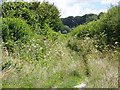
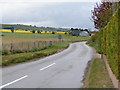
Byway to Middle Winterslow
The byway runs along the route of a Roman Road and it is part of the Monarch's Way.
Image: © Maigheach-gheal
Taken: 19 Jul 2008
0.14 miles
8
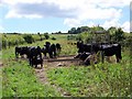
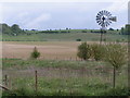
Cattle near Firsdown
The metal machine is a cattle crush for weighing the cattle.
Image: © Maigheach-gheal
Taken: 19 Jul 2008
0.15 miles
9
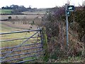
Bridleway sign, Middle Winterslow
The sign indicates that the bridleway right is some way down the road and the bridleway left (straight ahead) follows between a hedge and a fence. A bit tricky to notice if you did not have a map to indicate the correct line.
Image: © Maigheach-gheal
Taken: 18 Jan 2010
0.19 miles
10
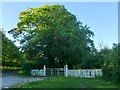
Disused entrance to New Manor Farm
There must once have been a rather grand approach to the farm from the south, with an avenue of trees. Vehicle access is now from the west, by way of a short, functional track.
Image: © Stefan Czapski
Taken: 26 May 2017
0.20 miles