IMAGES TAKEN NEAR TO
Wellsted Close, SALISBURY, SP5 1DE
Introduction
This page details the photographs taken nearby to Wellsted Close, SP5 1DE by members of the Geograph project.
The Geograph project started in 2005 with the aim of publishing, organising and preserving representative images for every square kilometre of Great Britain, Ireland and the Isle of Man.

There are currently over 7.5m images from over14,400 individuals and you can help contribute to the project by visiting https://www.geograph.org.uk
Image Map
Images are licensed for reuse under creativecommons.org/licenses/by-sa/2.0
Notes
- Clicking on the map will re-center to the selected point.
- The higher the marker number, the further away the image location is from the centre of the postcode.
Image Listing (5 Images Found)
Images are licensed for reuse under creativecommons.org/licenses/by-sa/2.0
Image
Details
Distance
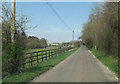
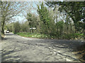
2
Hampshire-Wiltshire border by Granit-Ops
The photographer is in Hampshire and the border is on the far side of the road passing from right to left, which leads from Middle Winterslow to West Dean. The Granit-Ops sign points to the workshops of a kitchen and bathroom worktops manufacturer. To the left of this, a triangular lintel dated 1887 sits on top of two stones.
Image: © Peter Jordan
Taken: 23 Jun 2006
0.12 miles
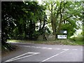
3
West Dean road junction with North Lane
On a shady part of the verge the welcome sight of primroses (Primula vulgaris). The cod wet winter has suited them admirably and they're making a fine show all over southern England.
Image: © Stuart Logan
Taken: 25 Apr 2013
0.13 miles