IMAGES TAKEN NEAR TO
St. Johns Close, SALISBURY, SP3 6PN
Introduction
This page details the photographs taken nearby to St. Johns Close, SP3 6PN by members of the Geograph project.
The Geograph project started in 2005 with the aim of publishing, organising and preserving representative images for every square kilometre of Great Britain, Ireland and the Isle of Man.

There are currently over 7.5m images from over14,400 individuals and you can help contribute to the project by visiting https://www.geograph.org.uk
Image Map
Images are licensed for reuse under creativecommons.org/licenses/by-sa/2.0
Notes
- Clicking on the map will re-center to the selected point.
- The higher the marker number, the further away the image location is from the centre of the postcode.
Image Listing (162 Images Found)
Images are licensed for reuse under creativecommons.org/licenses/by-sa/2.0
Image
Details
Distance
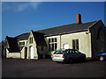
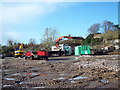
2
The Old Glove Factory
Once a place of employment now flats.
Image: © Maigheach-gheal
Taken: 17 Jan 2007
0.07 miles
3
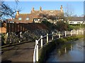
Riverside path, Tisbury
This attractive path runs alongside the River Nadder towards the church and village centre through the Stubbles area.
Image: © Derek Harper
Taken: 9 Jan 2011
0.10 miles
6
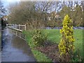
Flooded footpath, Tisbury
The River Nadder has flooded its banks at Stubbles after recent heavy rains.
Image: © Maigheach-gheal
Taken: 23 Jan 2009
0.10 miles
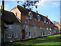
7
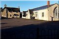
Hinton Hall and the church office in Tisbury
Located on the west side of St John the Baptist church. http://www.geograph.org.uk/photo/4313871 Hinton Hall is on the right.
Image: © Jaggery
Taken: 13 Dec 2014
0.11 miles
8

Alley from Becket Street to Church Street
Known locally as Spooky Alley.
Image: © Maigheach-gheal
Taken: 14 Feb 2008
0.12 miles
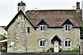
9
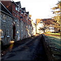
Lane from the Nadder towards the Crown Inn, Tisbury
The River Nadder is 35 metres behind the camera. At the far end of the lane, the Crown Inn http://www.geograph.org.uk/photo/4313829 is for sale in December 2014. The low wall is at the western edge of the churchyard of St John the Baptist.
Image: © Jaggery
Taken: 13 Dec 2014
0.12 miles
10
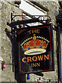
The Crown Inn Sign
There are more crowns than any other pub sign. In earlier days it may well have started when the inn was on Crown property. Without doubt the numbers have grown as a symbol of loyalty to the Throne.
Image: © Maigheach-gheal
Taken: 17 Jan 2007
0.12 miles