
IMAGES TAKEN NEAR TO
Manor Close, SALISBURY, SP3 4QF
Introduction
This page details the photographs taken nearby to Manor Close, SP3 4QF by members of the Geograph project.
The Geograph project started in 2005 with the aim of publishing, organising and preserving representative images for every square kilometre of Great Britain, Ireland and the Isle of Man.

There are currently over 7.5m images from over14,400 individuals and you can help contribute to the project by visiting https://www.geograph.org.uk
Image Map
Images are licensed for reuse under creativecommons.org/licenses/by-sa/2.0
Notes
- Clicking on the map will re-center to the selected point.
- The higher the marker number, the further away the image location is from the centre of the postcode.
Image Listing (110 Images Found)
Images are licensed for reuse under creativecommons.org/licenses/by-sa/2.0
Image
Details
Distance
1
![Shrewton features [1]](https://s3.geograph.org.uk/geophotos/06/39/88/6398803_b4222f2a_120x120.jpg)
Shrewton features [1]
This wall is enclosing the approach path to the church of St Mary. Part of the wall is 17th century extended in the late 18th or early 19th century. Listed, grade II, with details at: https://historicengland.org.uk/listing/the-list/list-entry/1253554
The village of Shrewton is located on Salisbury Plain and is made up of several early communities and was, until 1934 three separate parishes. The name Shrewton comes from the Old English word for sheriff’s farm or settlement. The village lies on the east to west road from London to Bridgwater via Amesbury and Warminster. The River Till which rises near Tilshead flows through the village on its way to join the River Wylye near Stapleford.
Image: © Michael Dibb
Taken: 29 Jan 2020
0.01 miles
2
![Shrewton houses [4]](https://s0.geograph.org.uk/geophotos/06/39/88/6398800_891245a4_120x120.jpg)
Shrewton houses [4]
Seen here from the footpath, The Old Vicarage, once known as Keeble, is dated 1704 with late 18th and early 19th century additions and a remodelling dated 1877. Traces of a Romano-British cemetery were discovered during the remodelling. The original range is in flint and limestone, the rest in brick and flint. See also Image and Image Listed, grade II, with details at: https://historicengland.org.uk/listing/the-list/list-entry/1355665
The village of Shrewton is located on Salisbury Plain and is made up of several early communities and was, until 1934 three separate parishes. The name Shrewton comes from the Old English word for sheriff’s farm or settlement. The village lies on the east to west road from London to Bridgwater via Amesbury and Warminster. The River Till which rises near Tilshead flows through the village on its way to join the River Wylye near Stapleford.
Image: © Michael Dibb
Taken: 29 Jan 2020
0.03 miles
3
![Shrewton houses [5]](https://s1.geograph.org.uk/geophotos/06/39/88/6398801_e15e36c8_120x120.jpg)
Shrewton houses [5]
A closer look at The Old Vicarage, once known as Keeble, is dated 1704 with late 18th and early 19th century additions and a remodelling dated 1877. Traces of a Romano-British cemetery were discovered during the remodelling. The original range is in flint and limestone, the rest in brick and flint. See also Image and Image Listed, grade II, with details at: https://historicengland.org.uk/listing/the-list/list-entry/1355665
The village of Shrewton is located on Salisbury Plain and is made up of several early communities and was, until 1934 three separate parishes. The name Shrewton comes from the Old English word for sheriff’s farm or settlement. The village lies on the east to west road from London to Bridgwater via Amesbury and Warminster. The River Till which rises near Tilshead flows through the village on its way to join the River Wylye near Stapleford.
Image: © Michael Dibb
Taken: 29 Jan 2020
0.03 miles
4
![Shrewton houses [6]](https://s2.geograph.org.uk/geophotos/06/39/88/6398802_bed47953_120x120.jpg)
Shrewton houses [6]
Seen from St Mary's churchyard, The Old Vicarage, once known as Keeble, is dated 1704 with late 18th and early 19th century additions and a remodelling dated 1877. Traces of a Romano-British cemetery were discovered during the remodelling. The original range is in flint and limestone, the rest in brick and flint. See also Image and Image Listed, grade II, with details at: https://historicengland.org.uk/listing/the-list/list-entry/1355665
The village of Shrewton is located on Salisbury Plain and is made up of several early communities and was, until 1934 three separate parishes. The name Shrewton comes from the Old English word for sheriff’s farm or settlement. The village lies on the east to west road from London to Bridgwater via Amesbury and Warminster. The River Till which rises near Tilshead flows through the village on its way to join the River Wylye near Stapleford.
Image: © Michael Dibb
Taken: 29 Jan 2020
0.03 miles

10
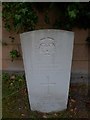
St Mary, Maddington: churchyard (VI)
Also see http://www.cwgc.org/find-war-dead/casualty/2710042/BOLTER,%20ALBERT%20EDWARD
Image: © Basher Eyre
Taken: 19 Aug 2016
0.04 miles