IMAGES TAKEN NEAR TO
High Street, SALISBURY, SP3 4DB
Introduction
This page details the photographs taken nearby to High Street, SP3 4DB by members of the Geograph project.
The Geograph project started in 2005 with the aim of publishing, organising and preserving representative images for every square kilometre of Great Britain, Ireland and the Isle of Man.

There are currently over 7.5m images from over14,400 individuals and you can help contribute to the project by visiting https://www.geograph.org.uk
Image Map
Images are licensed for reuse under creativecommons.org/licenses/by-sa/2.0
Notes
- Clicking on the map will re-center to the selected point.
- The higher the marker number, the further away the image location is from the centre of the postcode.
Image Listing (134 Images Found)
Images are licensed for reuse under creativecommons.org/licenses/by-sa/2.0
Image
Details
Distance
1
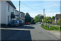
B3086 High Street, Maddington
Towards Shrewton.
Image: © Robin Webster
Taken: 30 May 2021
0.02 miles
2

Ivy covered tomb in St Marys Churchyard, Shrewton
Image: © Maigheach-gheal
Taken: 3 Feb 2007
0.02 miles
3
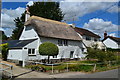
Thatched cottage in High Street, Shrewton
Image: © David Martin
Taken: 31 Jul 2018
0.03 miles
4
![Shrewton houses [36]](https://s1.geograph.org.uk/geophotos/07/38/10/7381057_8da6e81c_120x120.jpg)
Shrewton houses [36]
Oak Beams, High Street, is a detached house, built gable end to the street, in the early 18th century. Constructed of flint and limestone chequers, with brick to the left of the front and to the sides, all under a half-hipped thatch roof. There is a 20th century extension. Some original internal features and fittings remain. Listed, grade II, with details at: https://historicengland.org.uk/listing/the-list/list-entry/1023998
The village of Shrewton is located on Salisbury Plain and is made up of several early communities and was, until 1934 three separate parishes. The name Shrewton comes from the Old English word for sheriff’s farm or settlement. The village lies on the east to west road from London to Bridgwater via Amesbury and Warminster. The River Till which rises near Tilshead flows through the village on its way to join the River Wylye near Stapleford.
, brick stack to rear. Gable end to street. 2-storey, 3-window front. Central door, 3-light metal casement to right, 3- light recessed chamfered mullioned window with hoodmould to left. First floor has three 2-light casements and one single chamfered light over door. Right return has no windows. Rear is limestone and flint, lateral stack with toothed capping, one fixed window to ground floor. Left return has one 2-light casement to first floor, attached is C20 porch and flat-roofed extension. Interior has chamfered beams with step and runout stops, first floor has some wainscot partition and blocked open fireplace with chamfered stone lintel with bar stops.
Image: © Michael Dibb
Taken: 2 Jan 2023
0.03 miles
5
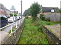
Shrewton, River Till
If there were water, this would be looking upstream at an apparent winterbourne that joins the Wylye at Stapleford.
Image: © Mike Faherty
Taken: 3 Oct 2013
0.03 miles
8
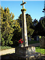
War Memorial at St Marys Church, Shrewton
Image: © Maigheach-gheal
Taken: 3 Feb 2007
0.04 miles