IMAGES TAKEN NEAR TO
Longhill Drive, SALISBURY, SP2 8TD
Introduction
This page details the photographs taken nearby to Longhill Drive, SP2 8TD by members of the Geograph project.
The Geograph project started in 2005 with the aim of publishing, organising and preserving representative images for every square kilometre of Great Britain, Ireland and the Isle of Man.

There are currently over 7.5m images from over14,400 individuals and you can help contribute to the project by visiting https://www.geograph.org.uk
Image Map
Images are licensed for reuse under creativecommons.org/licenses/by-sa/2.0
Notes
- Clicking on the map will re-center to the selected point.
- The higher the marker number, the further away the image location is from the centre of the postcode.
Image Listing (21 Images Found)
Images are licensed for reuse under creativecommons.org/licenses/by-sa/2.0
Image
Details
Distance
1
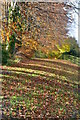
Autumn leaves beside A338 Downton Road
Image: © David Martin
Taken: 10 Nov 2012
0.08 miles
3
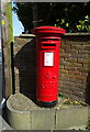
George V postbox on Downton Road
Postbox No. SP2 282.
Image: © JThomas
Taken: 22 Mar 2022
0.10 miles
5
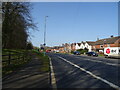
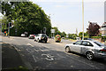
Odstock Road, Salisbury
Looking down Odstock Road from Coombe Road. Salisbury District Hospital is over the horizon right.
Image: © Peter Facey
Taken: 30 Jun 2006
0.14 miles
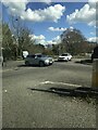
6
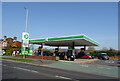
Service station on Downton Road
Petrol 169.9p.
Diesel 184.9p.
Image: © JThomas
Taken: 22 Mar 2022
0.15 miles
7
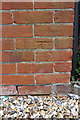
Benchmark on #21 Burford Road
Ordnance Survey cut mark benchmark described on the Bench Mark Database at http://www.bench-marks.org.uk/bm42267
Image: © Roger Templeman
Taken: 31 Mar 2012
0.17 miles
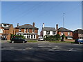
8
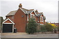
House #21 at junction of Burford Road and Burford Avenue
There is an OS benchmark Image on the blank face of the house
Image: © Roger Templeman
Taken: 31 Mar 2012
0.17 miles
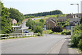
9
Junction of A338 and A354, Salisbury
Traffic approaching Salisbury on the A338 from Ringwood meet these lights as they enter the city. The A354 to Blandford is at left and is called Coombe Road.
Image: © Peter Facey
Taken: 30 Jun 2006
0.19 miles