IMAGES TAKEN NEAR TO
Dews Road, SALISBURY, SP2 7SN
Introduction
This page details the photographs taken nearby to Dews Road, SP2 7SN by members of the Geograph project.
The Geograph project started in 2005 with the aim of publishing, organising and preserving representative images for every square kilometre of Great Britain, Ireland and the Isle of Man.

There are currently over 7.5m images from over14,400 individuals and you can help contribute to the project by visiting https://www.geograph.org.uk
Image Map
Images are licensed for reuse under creativecommons.org/licenses/by-sa/2.0
Notes
- Clicking on the map will re-center to the selected point.
- The higher the marker number, the further away the image location is from the centre of the postcode.
Image Listing (815 Images Found)
Images are licensed for reuse under creativecommons.org/licenses/by-sa/2.0
Image
Details
Distance
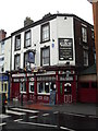
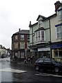
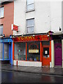
2
Florists at the junction of Dews Road and South Western Road
Image: © Basher Eyre
Taken: 1 Jun 2010
0.00 miles
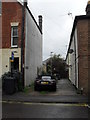
3
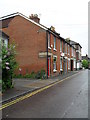
Approaching Sandown Place from Dews Road
Image: © Basher Eyre
Taken: 1 Jun 2010
0.01 miles
4
Approaching the junction of Dews Road and South Western Road
Image: © Basher Eyre
Taken: 1 Jun 2010
0.01 miles
5
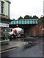
Cement mixer turning from Fisherton Street into South Western Road
Taken from Dews Road.
Image: © Basher Eyre
Taken: 1 Jun 2010
0.01 miles
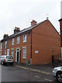
7
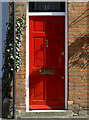
Door to number 10
The light striking at an angle gives a greater sense of depth of the doorway at the junction of Dew's Road and Sandown Place.
Image: © Neil Owen
Taken: 28 Mar 2012
0.02 miles
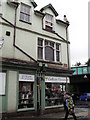
9
![Salisbury buildings [34]](https://s3.geograph.org.uk/geophotos/06/39/47/6394703_b152881d_120x120.jpg)
Salisbury buildings [34]
This interesting wedge shaped building at 109 Fisherton Street is home to a florists.
A cathedral was established at the Iron Age hillfort of Old Sarum by the Normans. In 1220 the cathedral was removed to the nearby plain and New Sarum (Salisbury) grew up around it, receiving a city charter in 1227. Located at the confluence of five rivers (Avon, Nadder, Ebble, Wylye and Bourne) the city is prone to flooding. Traffic between the ports of Southampton and Bristol, passes around the city's ring-road via the A36 causing much congestion.
Image: © Michael Dibb
Taken: 31 Dec 2019
0.02 miles