
IMAGES TAKEN NEAR TO
Cherry Close, SALISBURY, SP2 7JD
Introduction
This page details the photographs taken nearby to Cherry Close, SP2 7JD by members of the Geograph project.
The Geograph project started in 2005 with the aim of publishing, organising and preserving representative images for every square kilometre of Great Britain, Ireland and the Isle of Man.

There are currently over 7.5m images from over14,400 individuals and you can help contribute to the project by visiting https://www.geograph.org.uk
Image Map
Images are licensed for reuse under creativecommons.org/licenses/by-sa/2.0
Notes
- Clicking on the map will re-center to the selected point.
- The higher the marker number, the further away the image location is from the centre of the postcode.
Image Listing (91 Images Found)
Images are licensed for reuse under creativecommons.org/licenses/by-sa/2.0
Image
Details
Distance
1
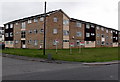
Cherry Close flats, Salisbury
Viewed from Cherry Orchard Lane.
Image: © Jaggery
Taken: 21 Sep 2013
0.00 miles
2
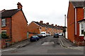
Orchard Road, Salisbury
Viewed from Cherry Orchard Lane.
Image: © Jaggery
Taken: 21 Sep 2013
0.04 miles
3
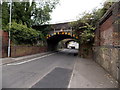
Twin low railway bridges over Cherry Orchard Lane, Salisbury
The bridges, 10 metres apart, carry railway lines over Cherry Orchard Lane.
Headroom shown on both bridges is 10' 3".
Image: © Jaggery
Taken: 21 Sep 2013
0.04 miles
4
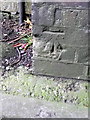
Bench Mark, Cherry Orchard Lane
The bench mark is to be found on the north east wall of the railway bridge. For a view of the bridge http://www.geograph.org.uk/photo/2061607 and for further information on the cut mark http://www.bench-marks.org.uk/bm35499
A bench mark is an Ordnance Survey arrowhead sign found on walls, bridges, churches and specially erected triangulation pillars where the altitude above sea-level has been accurately measured by surveyors. The arrowhead points to a horizontal line above it which marks the exact altitude.
With rivets and pivots there is no datum (horizontal line) cut, the pointed-to horizontal surface defining the datum height.
Image: © Maigheach-gheal
Taken: 11 Sep 2010
0.04 miles
5
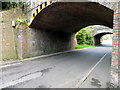
Railway bridges, Cherry Orchard Lane
On railway bridge E29/75 there is an Ordnance Survey bench mark.
Image: © Maigheach-gheal
Taken: 11 Sep 2010
0.04 miles
6
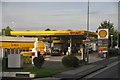
Salisbury : Shell Petrol Station
Looking towards a Shell Petrol station on Wilton Road.
Image: © Lewis Clarke
Taken: 23 Aug 2012
0.05 miles
7
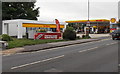
Jet Wash and Shell Filling Station, Wilton Road, Salisbury
Located in Wilton Road between Gorringe Road on the Jet Wash side and Cherry Orchard Lane ahead.
Image: © Jaggery
Taken: 21 Sep 2013
0.05 miles
8
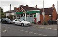
West End Post Office and Londis store in Salisbury
The post office inside a Londis is at 143-145 Wilton Road.
Image: © Jaggery
Taken: 21 Sep 2013
0.07 miles
9
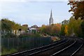
Railway at Churchfields
View south east along the railway that runs from Salisbury to Westbury. A footpath crosses the tracks at this point by a level crossing. In the distance can be seen the spire of Salisbury Cathedral.
Image: © Nigel Mykura
Taken: 30 Oct 2010
0.07 miles
10
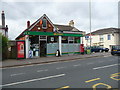
Salisbury - Post Office
Post Office and shop on Wilton Road.
Image: © Chris Talbot
Taken: 10 Jul 2011
0.07 miles