1
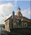
Wool House, Wilton
Wool House stands on Kingsbury Square and has an insurance fire plate displayed on the front.
Image: © Maigheach-gheal
Taken: 19 Nov 2010
0.01 miles
2
Wilton buildings [23]
The Greyhound Inn, Market Place, is a mid or late 18th century building. Constructed of painted brick under an old tile roof. There is a rear extension and a rear stable block. Listed, grade II, with details at: https://historicengland.org.uk/listing/the-list/list-entry/1198628
A former county town, Wilton is situated some 2¾ miles west of Salisbury on the confluence of the River Nadder and the River Wylye. The town grew around Wilton Abbey, founded in the 8th century, and was the administrative capital of Wiltshire until the 11th century. The town declined in importance after Salisbury Cathedral was built. The town is renowned for carpet manufacture, which began in 1741 when two French weavers were brought in and a carpet factory continued to operate until 1995. The country estate of Wilton House is an integral part of the town.
Image: © Michael Dibb
Taken: 25 Aug 2021
0.01 miles
3
Fire insurance plate, Wool House
Firemarks originated around the late 17th century at which time insurance companies operated their own fire brigades to protect insured property. As many buildings did not have a formal address until the advent of the postal system, insurance companies identified insured properties by placing a mark on the outside wall of the buildings. For a view of Wool House
Image
Image: © Maigheach-gheal
Taken: 19 Nov 2010
0.01 miles
4
Wilton houses [48]
The Wool House, number 2 Kingsbury Square, was built circa 1800. Constructed of painted brick under an old tile roof. There is a Sun fire insurance mark. Listed, grade II, with details at: https://historicengland.org.uk/listing/the-list/list-entry/1023708
A former county town, Wilton is situated some 2¾ miles west of Salisbury on the confluence of the River Nadder and the River Wylye. The town grew around Wilton Abbey, founded in the 8th century, and was the administrative capital of Wiltshire until the 11th century. The town declined in importance after Salisbury Cathedral was built. The town is renowned for carpet manufacture, which began in 1741 when two French weavers were brought in and a carpet factory continued to operate until 1995. The country estate of Wilton House is an integral part of the town.
Image: © Michael Dibb
Taken: 25 Aug 2021
0.01 miles
5
Wilton Baptist Church/Town Hall
The building is not only the Baptist Church, but town hall and a children's nursery.
Image: © Maigheach-gheal
Taken: 12 Jan 2007
0.01 miles
6
The Orange Way in Wiltshire (142)
Here is Wilton's Town Hall.
Image: © Shazz
Taken: 22 Apr 2013
0.01 miles
7
The Greyhound, Wilton
The Greyhound pub is a 17th century coaching inn. Wilton is on the A30 road, which is the old stagecoach route to the south-west.
Image: © mike smith
Taken: 10 Aug 2013
0.02 miles
8
Wilton houses [45]
Undergoing repairs, number 5 Market Place, was built in the mid 19th century. Constructed of brick with some flint under an old tile roof. Listed, for group value, grade II, with details at: https://historicengland.org.uk/listing/the-list/list-entry/1355783
A former county town, Wilton is situated some 2¾ miles west of Salisbury on the confluence of the River Nadder and the River Wylye. The town grew around Wilton Abbey, founded in the 8th century, and was the administrative capital of Wiltshire until the 11th century. The town declined in importance after Salisbury Cathedral was built. The town is renowned for carpet manufacture, which began in 1741 when two French weavers were brought in and a carpet factory continued to operate until 1995. The country estate of Wilton House is an integral part of the town.
Image: © Michael Dibb
Taken: 25 Aug 2021
0.02 miles
9
The Old Town Hall, Wilton
This magnificent building was erected in 1738. It is now longer the town hall, but since 1984, has been home to the Wilton Baptist Church.
Image: © mike smith
Taken: 10 Aug 2013
0.02 miles
10
Wilton Town Hall
From Silver Street. As the notice and several of the images at http://www.geograph.org.uk/search.php?i=51929033 make clear, this is now Wilton Baptist Church. The listed building description is at https://historicengland.org.uk/listing/the-list/list-entry/1023717 .
Image: © Derek Harper
Taken: 19 Jun 2014
0.02 miles


![Wilton buildings [23]](https://s2.geograph.org.uk/geophotos/07/04/72/7047262_494ca605_120x120.jpg)

![Wilton houses [48]](https://s0.geograph.org.uk/geophotos/07/04/72/7047284_ad1258a5_120x120.jpg)


![Wilton houses [45]](https://s0.geograph.org.uk/geophotos/07/04/72/7047264_35939b81_120x120.jpg)

