Fire insurance plate, Wool House
Introduction
The photograph on this page of Fire insurance plate, Wool House by Maigheach-gheal as part of the Geograph project.
The Geograph project started in 2005 with the aim of publishing, organising and preserving representative images for every square kilometre of Great Britain, Ireland and the Isle of Man.

There are currently over 7.5m images from over 14,400 individuals and you can help contribute to the project by visiting https://www.geograph.org.uk
Fire insurance plate, Wool House
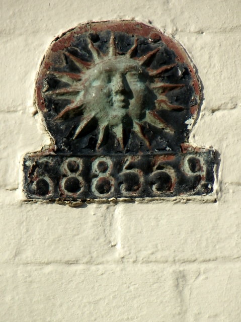
Image: © Maigheach-gheal Taken: 19 Nov 2010
Firemarks originated around the late 17th century at which time insurance companies operated their own fire brigades to protect insured property. As many buildings did not have a formal address until the advent of the postal system, insurance companies identified insured properties by placing a mark on the outside wall of the buildings. For a view of Wool House Image
Images are licensed for reuse under creativecommons.org/licenses/by-sa/2.0
Image Location
Latitude
51.07952
Longitude
-1.862751