1
Horse and rider on Phillips Lane
The chestnut horse is fitted with a western style saddle. The horse and rider are enjoying a Sunday morning hack.
Image: © Maigheach-gheal
Taken: 6 Jun 2010
0.02 miles
2
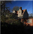
The Manor House - Stratford sub Castle
A late C16 or early C17 manor house, that appears to be unlisted by English Heritage.
Image: © Mike Searle
Taken: 30 Jan 2008
0.02 miles
3
The Manor House
Early to mid 17th Century manor house. The left hand end was added in 1880. Grade II listed - see https://historicengland.org.uk/listing/the-list/list-entry/1181774?section=official-list-entry.
Image: © Ian Capper
Taken: 22 Sep 2022
0.03 miles
4
The Manor House - Stratford sub Castle
Although dating from the late C16 or early C17, the manor house at Stratford sub Castle, somewhat surprisingly, does not appear to be a listed building.
Image: © Mike Searle
Taken: 30 Jan 2008
0.03 miles
5
Elizabeth II postbox and milestone on National Cycle Route 45, Dean's Farm
Salisbury 2 1/2 Miles / Amesbuery 7 1/2 Miles.
Postbox No. SP4 11.
See
Image] for postbox.
Image: © JThomas
Taken: 13 Jul 2019
0.04 miles
6
Dean's Farm, Stratford Bridge
Showing position of Postbox No. SP4 11.
See
Image] for postbox.
Image: © JThomas
Taken: 13 Jul 2019
0.04 miles
7
Dean's Farm
Farm near Stratford Bridge, now containing small business units.
Image: © Ian Capper
Taken: 22 Sep 2022
0.04 miles
8
Elizabeth II postbox, Dean's Farm
Postbox No. SP4 11.
See
Image] and
Image] for context.
Image: © JThomas
Taken: 13 Jul 2019
0.04 miles
9
Village scene, Stratford sub Castle
The finger post tells you that the road to Salisbury is part of the Route 45 of the National Cycle Network and the Wilts and Dorset bus heads to Salisbury.
Image: © Maigheach-gheal
Taken: 1 Mar 2011
0.04 miles
10
NCN Milestone, Stratford sub Castle
National Route 45 of the National Cycle Network when finished, will connect Salisbury in Wiltshire with Chester in Cheshire, via Swindon, Cirencester, Gloucester, Worcester and Whitchurch. Here the post tells cyclists that it is 2.5 miles to Salisbury and 7.7 miles to Amesbury.
A Queen Elizabeth II postbox is set into the brick wall.
Image: © Maigheach-gheal
Taken: 1 Mar 2011
0.04 miles


