IMAGES TAKEN NEAR TO
Hamilton Road, SALISBURY, SP1 3TF

Introduction

This page details the photographs taken nearby to Hamilton Road, SP1 3TF by members of the Geograph project.

The Geograph project started in 2005 with the aim of publishing, organising and preserving representative images for every square kilometre of Great Britain, Ireland and the Isle of Man.

There are currently over 7.5m images from over14,400 individuals and you can help contribute to the project by visiting https://www.geograph.org.uk

Image Map


Images are licensed for reuse under creativecommons.org/licenses/by-sa/2.0
Notes
  • Clicking on the map will re-center to the selected point.
  • The higher the marker number, the further away the image location is from the centre of the postcode.

Image Listing (178 Images Found)

Images are licensed for reuse under creativecommons.org/licenses/by-sa/2.0
  • ...
Image
Details
Distance
1
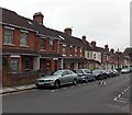
Hamilton Road, Salisbury
Viewed from the corner of Marlborough Road.
Image: © Jaggery Taken: 21 Sep 2013
0.04 miles
2
Hamilton Road
Mainly late 19th Century housing, first marked on the 1901 25 inch map, although the shop and the nearer row of houses on the right are later, being first on the 1926 edition.
Image: © Ian Capper Taken: 22 Sep 2022
0.04 miles
3
Castle roundabout subway
One of the four subways below the road level. See Image] for a view from the other side.
Image: © Neil Owen Taken: 23 Sep 2013
0.04 miles
4
Darker from this end
The subway in Castle roundabout, looking rather foreboding from this end. See Image] for a brighter look.
Image: © Neil Owen Taken: 23 Sep 2013
0.04 miles
5
Castle Street railway bridge, Salisbury
The bridge carries railway lines over Castle Street about 800 metres NE of Salisbury railway station.
Image: © Jaggery Taken: 21 Sep 2013
0.05 miles
6
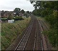
Towards Salisbury railway station
Viewed from a footbridge near Churchill Way North, looking SW.
Image: © Jaggery Taken: 21 Sep 2013
0.05 miles
7
Hamilton Road
A road first marked on the 1901 25 inch map and shown as mainly developed on that map, although the shop and the nearer row of houses seen here are later, being first on the 1926 edition.
Image: © Ian Capper Taken: 22 Sep 2022
0.05 miles
8
Yummy Express, Salisbury
Chinese takeaway on the corner of Hamilton Road and Castle Street. The premises were formerly occupied by Dragon Inn Chinese takeaway.
Image: © Jaggery Taken: 21 Sep 2013
0.05 miles
9
Castle roundabout, Salisbury
Image: © Helen Steed Taken: 17 Jul 2021
0.05 miles
10
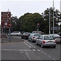
Straight ahead for Stonehenge, Salisbury
Stonehenge (about 12km away) is one of the tourist destinations shown on the brown sign at the edge of Castle Roundabout. Also shown are Old Sarum and the football ground.
Image: © Jaggery Taken: 21 Sep 2013
0.05 miles
  • ...