1
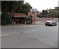
Cornwall Road, Salisbury
As a sign on the wall opposite says, it leads to Dorset, Cambridge and Somerset Roads. Firmly in the South, then.
Image: © Stephen Craven
Taken: 26 Sep 2018
0.05 miles
2
Salisbury, statue
In Victoria Park. On the base of the statue is the name Sidney Herbert, with no biographical detail; a search reveals that this was Baron Herbert of Lea, 1810-61, local MP and dignitary. The statue was relocated from near the Guildhall in 1953. http://history.wiltshire.gov.uk/community/getfaq.php?id=435
Image: © Mike Faherty
Taken: 11 Sep 2011
0.06 miles
3
Salisbury, bowling green
Home of Salisbury Victoria Bowls Club, in Victoria Park. http://www.salisburyvictoriabowlsclub.co.uk/
Image: © Mike Faherty
Taken: 11 Sep 2011
0.08 miles
4
Postbox, Salisbury
A Victorian reign postbox on the corner of Attwood Road.
Image: © Maigheach-gheal
Taken: 3 Mar 2010
0.09 miles
5
Car park in Victoria Park Salisbury
Viewed from Stratford Road. The car park is at the edge of the bowling green.
Image: © Jaggery
Taken: 21 Sep 2013
0.10 miles
6
Brick bus shelter, Stratford Road, Salisbury
Located near the Castle Road junction.
Image: © Jaggery
Taken: 21 Sep 2013
0.10 miles
7
Victoria Park, Salisbury
Between Stratford Road and Castle Road (the A345). The city retains plenty of green spaces.
Image: © Andrew Smith
Taken: 5 Aug 2007
0.11 miles
8
Salisbury, Victoria Park
Municipal park off Castle Hill, with facilities for football, tennis and bowling, and a playground. http://www.salisburycitycouncil.gov.uk/index.php?option=com_content&view=article&id=332&catid=38
Image: © Mike Faherty
Taken: 11 Sep 2011
0.11 miles
9
North end of Victoria Road, Salisbury
Note the postbox, and the right-turn lane in the centre of the road for cyclists to lead them to a cycle lane on the opposite pavement.
Image: © Stephen Craven
Taken: 26 Sep 2018
0.12 miles
10
Moberley Road, Salisbury
Houses on the north side of Moberley Road viewed from the corner of Victoria Road.
Image: © Jaggery
Taken: 21 Sep 2013
0.13 miles


