IMAGES TAKEN NEAR TO
Kings Road, SALISBURY, SP1 3AD

Introduction

This page details the photographs taken nearby to Kings Road, SP1 3AD by members of the Geograph project.

The Geograph project started in 2005 with the aim of publishing, organising and preserving representative images for every square kilometre of Great Britain, Ireland and the Isle of Man.

There are currently over 7.5m images from over14,400 individuals and you can help contribute to the project by visiting https://www.geograph.org.uk

Image Map


Images are licensed for reuse under creativecommons.org/licenses/by-sa/2.0
Notes
  • Clicking on the map will re-center to the selected point.
  • The higher the marker number, the further away the image location is from the centre of the postcode.

Image Listing (189 Images Found)

Images are licensed for reuse under creativecommons.org/licenses/by-sa/2.0
  • ...
Image
Details
Distance
1
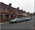
Nos 37 & 39 Wyndham Road, Salisbury
A typical style of house on this residential road. There is an Ordnance Survey bench mark on No 39, the right hand house.
Image: © Maigheach-gheal Taken: 15 Nov 2010
0.02 miles
2
Bench Mark, 39 Wyndham Road
The bench mark is to be found on the north east side of the building. For a wider view of the building Image and for further information on the cut mark http://www.bench-marks.org.uk/bm36016
Image: © Maigheach-gheal Taken: 15 Nov 2010
0.04 miles
3
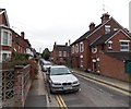
Hamilton Road, Salisbury
Viewed from the corner of Marlborough Road.
Image: © Jaggery Taken: 21 Sep 2013
0.04 miles
4
Marlborough Road, Salisbury
Viewed from the edge of a railway footbridge from Churchill Way North.
Image: © Jaggery Taken: 21 Sep 2013
0.04 miles
5
Hamilton Road, Salisbury
Viewed across Castle Street looking towards Marlborough Road.
Image: © Jaggery Taken: 21 Sep 2013
0.04 miles
6
Postbox on Marlborough Road
On the corner of Hamilton Road.
Image: © Stephen Craven Taken: 26 Sep 2018
0.05 miles
7
Wyndham Road Salisbury
Viewed across Castle Street.
Image: © Jaggery Taken: 21 Sep 2013
0.05 miles
8
Railway west of Marlborough Road footbridge
Looking towards Salisbury.
Image: © Stephen Craven Taken: 26 Sep 2018
0.07 miles
9
Northern end of a railway footbridge to Marlborough Road, Salisbury
Viewed from a Churchill Way North footbridge. The identifier on the railway footbridge is BAE1 E4/230 82M 67CH.
Image: © Jaggery Taken: 21 Sep 2013
0.08 miles
10
Cycle route signage alongside Churchill Way North, Salisbury
Right for the city centre, on a "quietway" for cyclists and pedestrians from the northern suburbs. Ahead is a footbridge over the railway leading to Marlborough Road.
Image: © Stephen Craven Taken: 26 Sep 2018
0.08 miles
  • ...