1
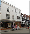
Umbrellas up passing Crane Street
Image: © Basher Eyre
Taken: 1 Jun 2010
0.00 miles
2
High Street and the North Gate, Salisbury
This is the first week of the Easter Holidays for most schools and numerous school-age children were out and about in the pleasant mid April sunshine.
Image: © Brian Robert Marshall
Taken: 12 Apr 2011
0.00 miles
3
National Trust shop in Salisbury
The turquoise shop front is in the House of Steps, 41 High Street.
Image: © Jaggery
Taken: 21 Sep 2013
0.00 miles
4
Sloanes for Hair, Salisbury
The hairdressers on the left is next door to the High Street post office and bureau de change.
Image: © Jaggery
Taken: 21 Sep 2013
0.00 miles
5
Building, corner of High and Crane Streets, Salisbury
A grade II*(star) listed building from about 1400.
Image: © Robin Webster
Taken: 16 Dec 2017
0.01 miles
6
Salisbury buildings [8]
Originally a row of three houses, numbers 52 and 54 High Street with massive timber framing is 14th or 15th century. There is a small painted brick extension to the right on Crane Street. There is much detail, including plans of the building (monument number 82) at: https://www.british-history.ac.uk/rchme/salisbury/pp66-72 It is a tragedy that the ground floor has been so completely and badly altered. Listed, grade II*, with details at: https://historicengland.org.uk/listing/the-list/list-entry/1023686
A cathedral was established at the Iron Age hillfort of Old Sarum by the Normans. In 1220 the cathedral was removed to the nearby plain and New Sarum (Salisbury) grew up around it, receiving a city charter in 1227. Located at the confluence of five rivers (Avon, Nadder, Ebble, Wylye and Bourne) the city is prone to flooding. Traffic between the ports of Southampton and Bristol, passes around the city's ring-road via the A36 causing much congestion.
Image: © Michael Dibb
Taken: 31 Dec 2019
0.01 miles
7
In Salisbury - Old buildings at junction of Crane St, New St & High St
Image: © Colin Park
Taken: 3 May 1975
0.01 miles
8
Salisbury High Street: 'Prezzo', Italian chain restaurant
Image: © Michael Garlick
Taken: 29 Sep 2021
0.01 miles
9
Junction of New Street, Crane Street & High Street, Salisbury
New Street behind photographer; Crane Street ahead; High Street crossing left to right. Entrance to Cathedral Close via North Gate off picture left.
Image: © Peter Facey
Taken: 18 Jun 2006
0.01 miles
10
52 & 54 High Street Salisbury
A C14th/C15th building Grade II* Listed https://historicengland.org.uk/listing/the-list/list-entry/1023686 .
Image: © Rod Allday
Taken: 7 Mar 2013
0.01 miles


![Salisbury buildings [8]](https://s1.geograph.org.uk/geophotos/06/39/06/6390677_f1edb4b4_120x120.jpg)


