IMAGES TAKEN NEAR TO
Ludgershall Road, ANDOVER, SP11 9AF

Introduction

This page details the photographs taken nearby to Ludgershall Road, SP11 9AF by members of the Geograph project.

The Geograph project started in 2005 with the aim of publishing, organising and preserving representative images for every square kilometre of Great Britain, Ireland and the Isle of Man.

There are currently over 7.5m images from over14,400 individuals and you can help contribute to the project by visiting https://www.geograph.org.uk

Image Map


Images are licensed for reuse under creativecommons.org/licenses/by-sa/2.0
Notes
  • Clicking on the map will re-center to the selected point.
  • The higher the marker number, the further away the image location is from the centre of the postcode.

Image Listing (14 Images Found)

Images are licensed for reuse under creativecommons.org/licenses/by-sa/2.0
Image
Details
Distance
1
A342 Andover road at Privet Lane
Image: © John Firth Taken: 17 Apr 2013
0.01 miles
2
A342 westbound
Image: © Alex McGregor Taken: 18 Jul 2012
0.01 miles
3
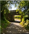
Railway bridge over road to Shoddesden
Just off the A342 the minor road to Shoddesden goes under the railway bridge
Image: © Shaun Ferguson Taken: 27 Jun 2007
0.02 miles
4
Privet Road crossroads
Approaching the Andover Road from the south.
Image: © Jonathan Billinger Taken: 7 Nov 2013
0.06 miles
5
Norway Maple by Privet Lane
Acer platanoides is not indigenous and rarely pops up in a field setting like this. The autumn colour is far richer than the native Field Maple - Acer campestre, and closely-related Sycamore. Hill Copse can be seen beyond.
Image: © Jonathan Billinger Taken: 7 Nov 2013
0.07 miles
6
Woodland west of Privet Lane
Probably part of the grounds of Redenham House.
Image: © Robin Webster Taken: 7 Feb 2017
0.07 miles
7
Privet Lane
Heading towards Redenham.
Image: © Robin Webster Taken: 7 Feb 2017
0.07 miles
8
Approaching Privet Lane railway bridge (M&SWJR) from the main Andover road
These days this bridge carries a line that runs no further than the army depot at Ludgershall. But it was built to carry the old M&SWJR's cross-country route which ran north to Swindon and beyond. The little Midland and South Western Junction Railway had its headquarters in Swindon, having set up shop in the heart of Great Western territory. It was absorbed by the GWR at the time of the Grouping in 1923. The MSWJ line was closed to passenger traffic by British Railways in 1961, and it seems that in post WW2 days scheduled services were very sparse. That being the case, there can't be many people around who can match my (faint) boyhood memories of a journey south from Swindon to Andover. The ticket was marked 'via Rushey Platt'.
Image: © Stefan Czapski Taken: 6 Jun 2015
0.09 miles
9
Railway bridge over Privet Lane
Bridge LUD2 E5/28 is on the freight only branch to Ludgershall and its military continuation to the military depot there. The branch does not appear to have any regular use. This was formerly part of the long cross-country Midland and South Western Junction line to Andoversford Junction near Cheltenham. This is abandoned beyond Ludgershall.
Image: © Robin Webster Taken: 20 Mar 2015
0.10 miles
10
Railway bridge over Privet Lane
Bridge LUD2 E5/28 is on the freight only branch to Ludgershall and its military continuation to the military depot there. The branch does not appear to have any regular use. This was formerly part of the long cross-country Midland and South Western Junction line to Andoversford Junction near Cheltenham. This is abandoned beyond Ludgershall.
Image: © Robin Webster Taken: 7 Feb 2017
0.10 miles