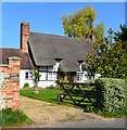
IMAGES TAKEN NEAR TO
Stoke, ANDOVER, SP11 0NR

Introduction

This page details the photographs taken nearby to SP11 0NR by members of the Geograph project.

The Geograph project started in 2005 with the aim of publishing, organising and preserving representative images for every square kilometre of Great Britain, Ireland and the Isle of Man.

There are currently over 7.5m images from over14,400 individuals and you can help contribute to the project by visiting https://www.geograph.org.uk

Image Map


Images are licensed for reuse under creativecommons.org/licenses/by-sa/2.0
Notes
  • Clicking on the map will re-center to the selected point.
  • The higher the marker number, the further away the image location is from the centre of the postcode.

Image Listing (17 Images Found)

Images are licensed for reuse under creativecommons.org/licenses/by-sa/2.0
Image
Details
Distance
1
Cob (thatched) wall and small barn
A traditional thatched wall directly linked to a small barn. The wall appears to be made of chalk- a local material sometimes seen on houses,
Image: © Carmen Taken: 1 Aug 2020
0.02 miles
2
Minor road through Stoke
Road northwest through Stoke, to Slade Bottom Farm. The White Hart Inn is on the right. Picture take from the bridge over the Bourne Rivulet.
Image: © Roger Thomas Taken: 21 Jan 2007
0.03 miles
3
The Road to Binley, Stoke, North Hampshire
Image: © nick macneill Taken: 12 Mar 2010
0.03 miles
4
Winterbourne Cottage
Image: © Colin Bates Taken: 2 Jan 2006
0.04 miles
5
Octagonal Cottage, Stoke
Image: © Colin Bates Taken: 2 Jan 2006
0.04 miles
6
Telephone box at Stoke
Telephone box by the road-bridge over the Bourne Rivulet in Stoke.
Image: © Roger Thomas Taken: 21 Jan 2007
0.05 miles
7
Bridge Cottage, St Mary Bourne, Hampshire
C17, and modern. One storey and attic, irregular fenestration. Thatched roof, eyebrow dormers and extended above a modern porch; tiled roof to a single-storeyed modern extension on the west side. Exposed frame with painted brick infill. Casements. Modern boarded porch. (Source:Historic England)
Image: © Oswald Bertram Taken: 2 Oct 2015
0.05 miles
8
Bourne Rivulet at Stoke
Looking northwest along the Bourne Rivulet. The river is a winterbourne which means it only flows from late winter when the water table is up.
Image: © Roger Thomas Taken: 21 Jan 2007
0.06 miles
9
Junction with B3048 at Stoke
B3048 heading northwest through Stoke, with road to the right heading northeast.
Image: © Roger Thomas Taken: 21 Jan 2007
0.08 miles
10
Crossroads, Stoke
Chapel Lane, across the main B3048 road, is a dead end.
Image: © Robin Webster Taken: 25 Oct 2014
0.08 miles