1
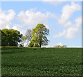
Junction near Pill Heath Farm
This is a minor country junction, with an appropriately old fingerpost, but it lists many places. It is surrounded on all sides by arable land like this.
Image: © Graham Horn
Taken: 27 Nov 2008
0.03 miles
2
Old signpost at Pill Heath
It is interesting to note that some of the mileages are shown to the nearest eighth.
Image: © Colin Park
Taken: 10 Dec 1988
0.04 miles
3
Footpath to Blagden Copse
From a minor road this footpath heads east along a field boundary, towards Blagden Copse in the distance.
Image: © Graham Horn
Taken: 27 Nov 2008
0.08 miles
4
Lane towards Eastend Farm
The tall trees are on the site of a small disused chalk pit.
Image: © Robin Webster
Taken: 29 Nov 2014
0.10 miles
5
Footpath to Blagdon Copse
The footpath uses the field headland.
Image: © Maigheach-gheal
Taken: 27 Nov 2008
0.10 miles
6
View south over farmland near Tangley, Hampshire
Image: © Edmund Shaw
Taken: 12 May 2015
0.12 miles
7
Farmland, Tangley, Hampshire
Image: © Oswald Bertram
Taken: 13 May 2015
0.12 miles
8
Farmland, Tangley
A crop of wheat to the south of the footpath heading from Pill Heath to Blagden Copse.
Image: © Andrew Smith
Taken: 21 May 2023
0.15 miles
9
Field and buffer strip near Whistler's Farm, Hampshire
The campions in the foreground inhabit a strip of vegetation at the top of a field of barley.
Buffer strips have several uses (wikipedia reference: http://en.wikipedia.org/wiki/Buffer_strip#Types_of_buffer_strips ), and the purpose of this one is unclear.
Image: © Edmund Shaw
Taken: 12 May 2015
0.23 miles
10
Barns, Eastend Farm
There are only barns at this site now, older maps suggest there once was a farmhouse as well.
Image: © Robin Webster
Taken: 29 Nov 2014
0.23 miles


